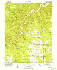
1951 Map of Hartshorn
USGS Topo · Published 1956About this map
Hartshorn stands as the primary settlement in this part of the Missouri Ozarks during the early 1950s, situated near the intersection of several local roads. The landscape is defined by the winding course of the Current River and its numerous tributaries, including Big Creek and South Fork Black Valley Creek. This terrain is deeply dissected by named hollows such as Cummins Hollow, Huldy Hollow, and Rebel Cave Hollow, reflecting a classic Ozark drainage pattern where small communities and farmsteads cluster along narrow valleys and ridges.
Find a feature on this map
24 named features on this map. Tap any name to fly to it.
Don’t see what you’re looking for? This feature index may not catch every label — zoom into the map to look around manually.
Map Details
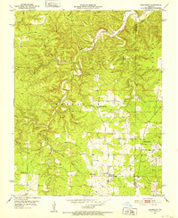
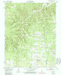
Editions of this 1951 Hartshorn Map
4 editions found

Other maps of this area

1932 · Cedar Grove
USGS Topo · 1:48,000

1945 · Clear Springs
USGS Topo · 1:62,500

1946 · Summersville
USGS Topo · 1:62,500

1948 · Clear Springs
USGS Topo · 1:62,500

1948 · Summersville
USGS Topo · 1:62,500

1949 · Rolla
USGS Topo · 1:250,000

1951 · Montauk
USGS Topo · 1:24,000

1951 · Licking
USGS Topo · 1:24,000

1951 · Cedargrove
USGS Topo · 1:24,000

1951 · Raymondville
USGS Topo · 1:24,000