
1951 Map of Hartshorn
USGS Topo · Published 1977About this map
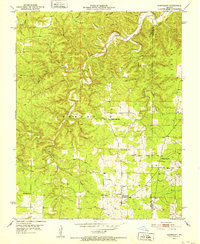
Hartshorn and the surrounding timberlands of the Missouri Ozarks are documented here during the early 1950s. The landscape is defined by the deep dissection of the Current River and its primary tributaries, notably Big Creek and the South Fork Black Valley Creek. This geography created a decentralized pattern of life, where social hubs like Nile Sch and Round Valley Sch served isolated hollows. The rural economy of the era is visible in the network of unimproved roads and small clearings among the heavy forest cover. Family history is anchored by markers such as Smith Cem and Antioch Cem, while the spiritual life of the community centered on Center Valley Ch. Notable terrain features like Rebel Cave Hollow and Bee Rock Hollow highlight the traditional nomenclature of the region's complex karst topography.
Find a feature on this map
25 named features on this map. Tap any name to fly to it.
Don’t see what you’re looking for? This feature index may not catch every label — zoom into the map to look around manually.
Map Details
Editions of this 1951 Hartshorn Map
4 editions found
Other maps of this area

1932 · Cedar Grove
USGS Topo · 1:48,000

1945 · Clear Springs
USGS Topo · 1:62,500

1946 · Summersville
USGS Topo · 1:62,500

1948 · Clear Springs
USGS Topo · 1:62,500

1948 · Summersville
USGS Topo · 1:62,500

1949 · Rolla
USGS Topo · 1:250,000

1951 · Montauk
USGS Topo · 1:24,000

1951 · Licking
USGS Topo · 1:24,000

1951 · Cedargrove
USGS Topo · 1:24,000

1951 · Raymondville
USGS Topo · 1:24,000