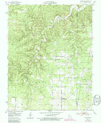
1951 Map of Hartshorn
USGS Topo · Published 1985About this map
Hartshorn and the surrounding timberlands of Hartshorn State Forest define this landscape along the Texas and Shannon County line. Surveyed in the mid-20th century with updates through the early 1980s, the map reveals a rural Ozark community organized around isolated schools and churches. The intricate drainage network of the Current River and Big Creek dictates the placement of early settlements and family landmarks.
Find a feature on this map
24 named features on this map. Tap any name to fly to it.
Don’t see what you’re looking for? This feature index may not catch every label — zoom into the map to look around manually.
Map Details
Editions of this 1951 Hartshorn Map
4 editions found

Other maps of this area

1932 · Cedar Grove
USGS Topo · 1:48,000

1945 · Clear Springs
USGS Topo · 1:62,500

1946 · Summersville
USGS Topo · 1:62,500

1948 · Clear Springs
USGS Topo · 1:62,500

1948 · Summersville
USGS Topo · 1:62,500

1949 · Rolla
USGS Topo · 1:250,000

1951 · Montauk
USGS Topo · 1:24,000

1951 · Licking
USGS Topo · 1:24,000

1951 · Cedargrove
USGS Topo · 1:24,000

1951 · Raymondville
USGS Topo · 1:24,000