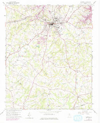
1959 Map of Hartwell
USGS Topo · Published 1975About this map
The city of Hartwell serves as the central hub of this mid-century Georgia landscape, situated just south of the developing finger-lakes created by Lake Hartwell. The area is characterized by a dense network of country roads connecting numerous rural congregations and burial grounds, such as Bethesda Ch, Bio Ch, and Liberty Hill Ch Cem. The local economy of the late 1950s and early 1970s is reflected in a mix of traditional land use and modern infrastructure, including a Strip Mine south of town, a Drive-in Theater, and the local Radio Tower (WKLY). To the south, the settlement of Nuberg sits near the crossing of Coldwater Creek, while educational landmarks like Nancy Hart Sch and the High Sch anchor the community's civic life. The terrain is marked by the Hart Co Elbert Co boundary line, winding through a landscape of creek branches and flat shoals.
Find a feature on this map
49 named features on this map. Tap any name to fly to it.
Don’t see what you’re looking for? This feature index may not catch every label — zoom into the map to look around manually.
Map Details
Editions of this 1959 Hartwell Map
2 editions found

Other maps of this area

1891 · Carnesville
USGS Topo · 1:125,000

1893 · Elberton
USGS Topo · 1:125,000

1954 · Greenville
USGS Topo · 1:250,000

1958 · Greenville
USGS Topo · 1:250,000

1958 · Danielsville
USGS Topo · 1:62,500

1958 · Elberton
USGS Topo · 1:62,500

1959 · Hartwell Dam
USGS Topo · 1:24,000

1959 · Lavonia
USGS Topo · 1:24,000

1959 · Hartwell NE
USGS Topo · 1:24,000

1959 · Royston
USGS Topo · 1:24,000