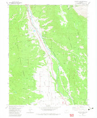
1982 Map of Harvard Lakes
USGS Topo · Published 1983About this map
The Arkansas River valley serves as a busy corridor for industry and transit in this high-altitude landscape, where the Denver and Rio Grande Western railroad tracks parallel the river's course. Small settlements like Riverside and Americus are positioned along this vital north-south artery, which also supports a network of water management features including the Riverside Ditch and an aqueduct. To the west, the terrain rises into the San Isabel National Forest, where the Harvard Lakes sit at the base of steep slopes. This area is crisscrossed by historic routes like the Wapaca Trail and numerous unnamed pack trails. Mining activity is evident on both sides of the river, with the Little Annie Mine and various unspecified mines dotting the hillsides, reflecting a long history of mineral extraction near landmarks like Elephant Rock.
Find a feature on this map
40 named features on this map. Tap any name to fly to it.
Don’t see what you’re looking for? This feature index may not catch every label — zoom into the map to look around manually.
Map Details
Editions of this 1982 Harvard Lakes Map
2 editions found
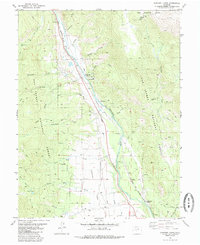
Other maps of this area

1889 · Leadville
USGS Topo · 1:125,000

1891 · Leadville
USGS Topo · 1:125,000

1935 · Mount Elbert
USGS Topo · 1:62,500

1938 · Mount Elbert
USGS Topo · 1:62,500

1939 · Mount Elbert
USGS Topo · 1:62,500

1942 · Leadville
USGS Topo · 1:125,000

1955 · Buena Vista
USGS Topo · 1:62,500

1955 · Mount Harvard
USGS Topo · 1:62,500

1956 · Montrose
USGS Topo · 1:250,000

1957 · Leadville
USGS Topo · 1:250,000