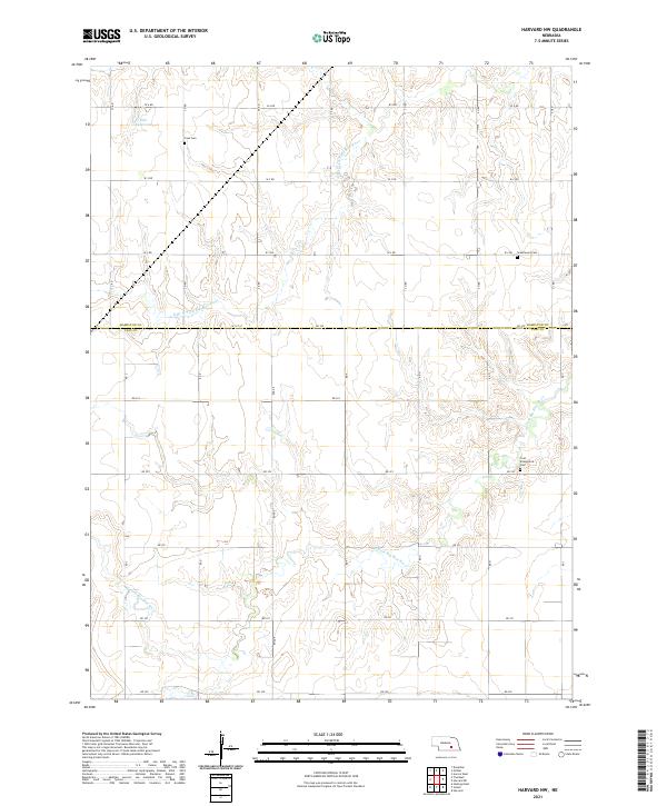
2021 Map of Harvard NW
USGS Topo · Published 2021About this map
The agrarian landscape of the Hamilton Co Clay Co border area is defined by the winding paths of the N Br W Fork Big Blue River and the W Fork Big Blue River. This 2021 survey shows a geometric grid of section roads like RD 325 and Road E imposed upon the natural drainage of the Big Blue River system. Small, isolated burial grounds including First Evangelical Cem, Case Cem, and Greenwood Cem serve as quiet markers of the region's rural settlement history. Near the northern boundary, the Bish Reservoir provides a localized water source amidst the rolling agricultural fields that dominate the topography.
Find a feature on this map
35 named features on this map. Tap any name to fly to it.
Don’t see what you’re looking for? This feature index may not catch every label — zoom into the map to look around manually.
Map Details
Editions of this 2021 Harvard NW Map
This is the sole edition of this map. No revisions or reprints were ever made.
Other maps of this area

1892 · Grand Island
USGS Topo · 1:62,500

1895 · Grand Island
USGS Topo · 1:62,500

1898 · Grand Island
USGS Topo · 1:125,000

1955 · Grand Island
USGS Topo · 1:250,000

1957 · Grand Island
USGS Topo · 1:250,000

1958 · Grand Island
USGS Topo · 1:250,000
1962 · Doniphan
USGS Topo · 1:24,000
1967 · Giltner
USGS Topo · 1:24,000
1968 · Aurora West
USGS Topo · 1:24,000

1969 · Hastings East
USGS Topo · 1:24,000