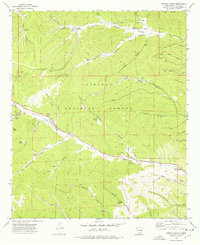
1974 Map of Harvey Ranch
USGS Topo · Published 1978About this map
Harvey Ranch and the surrounding high country of the Lincoln National Forest dominate this mid-1970s survey of the Sacramento Mountains. The landscape is defined by an intricate network of drainage systems, including the prominent James Canyon and Sixteen Springs, where local history is anchored by the Sixteen Springs Cemetery and the Christadelphian Church. The area shows a clear pattern of high-altitude land use, with fire observation points like James Ridge Lookout overlooking a territory marked by numerous named water sources such as Mc Natt Spring and Dollins Springs. Small-scale infrastructure is visible throughout the canyons, ranging from the Gaging Station on the creek to the James Canyon Campground and the Myers Trail, illustrating how the mountainous terrain of Otero County was managed for both resource protection and recreation during this era.
Find a feature on this map
43 named features on this map. Tap any name to fly to it.
Don’t see what you’re looking for? This feature index may not catch every label — zoom into the map to look around manually.
Map Details
Editions of this 1974 Harvey Ranch Map
This is the sole edition of this map. No revisions or reprints were ever made.
Other maps of this area

1952 · Cloudcroft
USGS Topo · 1:62,500

1954 · Carlsbad
USGS Topo · 1:250,000

1955 · Roswell
USGS Topo · 1:250,000

1958 · Carlsbad
USGS Topo · 1:250,000

1958 · Roswell
USGS Topo · 1:250,000

1962 · Roswell
USGS Topo · 1:250,000

1963 · Mayhill
USGS Topo · 1:24,000

1963 · Turkey Peak
USGS Topo · 1:24,000

1963 · Woodson Canyon
USGS Topo · 1:24,000

1963 · Firman Canyon
USGS Topo · 1:24,000