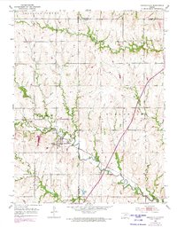
1952 Map of Harveyville
USGS Topo · Published 1973About this map
Harveyville sits at a geographic crossroads on this mid-century survey, where the Atchison Topeka and Santa Fe railroad line intersects the town's grid. The landscape is defined by a dense network of watercourses, including Dragoon Creek and the South Branch Wakarusa River, which carve through the terrain of the Burlingame district. A 1970s revision layer highlights the modern path of the Kansas Turnpike (Toll Road) slicing diagonally across the eastern township lines, contrasting with the older rural infrastructure like the Bellview Sch (Abandoned) and Sharon Sch. This map documents a transitional period for Wabaunsee and Osage counties, as the high-speed turnpike era began to overlay the traditional rail-and-creek orientation of these Kansas farming communities. Near the southern border, Historical Markers and Smith Lake provide specific points of interest for local history researchers.
Find a feature on this map
16 named features on this map. Tap any name to fly to it.
Don’t see what you’re looking for? This feature index may not catch every label — zoom into the map to look around manually.
Map Details
Editions of this 1952 Harveyville Map
3 editions found
Other maps of this area

1885 · Eskridge
USGS Topo · 1:125,000

1889 · Burlingame
USGS Topo · 1:125,000

1889 · Eskridge
USGS Topo · 1:125,000

1894 · Eskridge
USGS Topo · 1:125,000

1894 · Burlingame
USGS Topo · 1:125,000

1947 · Lawrence
USGS Topo · 1:250,000

1950 · Lawrence
USGS Topo · 1:250,000

1952 · Auburn
USGS Topo · 1:24,000

1952 · Harveyville
USGS Topo · 1:24,000
1952 · Dover
USGS Topo · 1:24,000