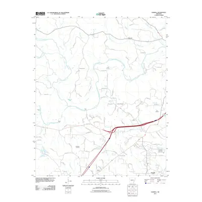
2011 Map of Haskell
USGS Topo · Published 2011About this map
The Alum Fork Saline River and its numerous tributaries, including Middle Fork Saline River and South Fork Saline River, define the landscape of this Saline County region. This 2011 survey captures the area as modern infrastructure intersects with long-established rural landmarks. Genealogical and local history points of interest are plentiful, with several family-named burial grounds like James Cemetery, Hammonds Cemetery, and Winters Cemetery situated near old river crossings. Traditional water navigation and access points are preserved in the labeling of Will James Ford, Smith Ford, and Nelson Ford. The settlement of Haskell anchors the southern portion of the map near the Buffington Lake Dam, while the community of Kentucky and the scout facilities at Camp Quapaw occupy the northern terrain. A dense network of local roads and trails, such as Quapaw Trl and Nickel Bill James Rd, suggests a landscape transitioning between its deep-rooted agricultural past and contemporary development.
Find a feature on this map
109 named features on this map. Tap any name to fly to it.
Don’t see what you’re looking for? This feature index may not catch every label — zoom into the map to look around manually.
Map Details
Editions of this 2011 Haskell Map
This is the sole edition of this map. No revisions or reprints were ever made.
Other maps of this area

1890 · Benton
USGS Topo · 1:125,000

1894 · Benton
USGS Topo · 1:125,000

1938 · Benton
USGS Topo · 1:48,000

1944 · Benton
USGS Topo · 1:62,500

1944 · Benton
USGS Topo · 1:31,680

1948 · Malvern
USGS Topo · 1:62,500

1949 · Malvern
USGS Topo · 1:62,500

1955 · Little Rock
USGS Topo · 1:250,000

1956 · Little Rock
USGS Topo · 1:250,000

1960 · Little Rock
USGS Topo · 1:250,000