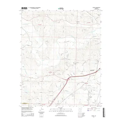
2014 Map of Haskell
USGS Topo · Published 2014About this map
The Alum Fork Saline River and South Fork Saline River converge in this Saline County landscape, framing a region defined by established communities and family heritage. In the eastern portion, the city of Benton and the town of Haskell show significant modern infrastructure, while the northern settlement of Kentucky maintains its distinct identity along the Ar-5 corridor. For those tracing local history, the landscape is dotted with several family cemeteries, including James Cem, Hammonds Cem, and Moore Cem, which serve as physical anchors for the region's genealogy.
Find a feature on this map
116 named features on this map. Tap any name to fly to it.
Don’t see what you’re looking for? This feature index may not catch every label — zoom into the map to look around manually.
Map Details
Editions of this 2014 Haskell Map
This is the sole edition of this map. No revisions or reprints were ever made.
Other maps of this area

1890 · Benton
USGS Topo · 1:125,000

1894 · Benton
USGS Topo · 1:125,000

1938 · Benton
USGS Topo · 1:48,000

1944 · Benton
USGS Topo · 1:62,500

1944 · Benton
USGS Topo · 1:31,680

1948 · Malvern
USGS Topo · 1:62,500

1949 · Malvern
USGS Topo · 1:62,500

1955 · Little Rock
USGS Topo · 1:250,000

1956 · Little Rock
USGS Topo · 1:250,000

1960 · Little Rock
USGS Topo · 1:250,000