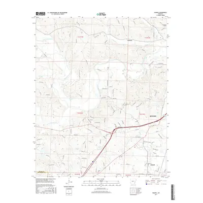
2017 Map of Haskell
USGS Topo · Published 2017About this map
Benton and the surrounding Saline County countryside are defined by the convergence of the Alum Fork Saline River and South Fork Saline River, which dominate the central landscape. The 2017 survey reveals a region with a mix of established municipal growth in the east and smaller rural pockets like Kentucky and Haskell to the south. Numerous family-named landmarks and historical burial sites, including James Cem, Hammonds Cem, and Moore Cem, are scattered throughout the township grids, offering valuable reference points for genealogical research. The waterway network is dense, featuring significant tributaries such as Trace Cr, Clift Cr, and Brushy Cr that drain into the larger river forks. Several reservoirs, notably Masoner Lake and Buffington Lake, suggest a landscape shaped by local water management and recreation within the diverse terrain of Stillhouse Hollow.
Find a feature on this map
126 named features on this map. Tap any name to fly to it.
Don’t see what you’re looking for? This feature index may not catch every label — zoom into the map to look around manually.
Map Details
Editions of this 2017 Haskell Map
This is the sole edition of this map. No revisions or reprints were ever made.
Other maps of this area

1890 · Benton
USGS Topo · 1:125,000

1894 · Benton
USGS Topo · 1:125,000

1938 · Benton
USGS Topo · 1:48,000

1944 · Benton
USGS Topo · 1:62,500

1944 · Benton
USGS Topo · 1:31,680

1948 · Malvern
USGS Topo · 1:62,500

1949 · Malvern
USGS Topo · 1:62,500

1955 · Little Rock
USGS Topo · 1:250,000

1956 · Little Rock
USGS Topo · 1:250,000

1960 · Little Rock
USGS Topo · 1:250,000