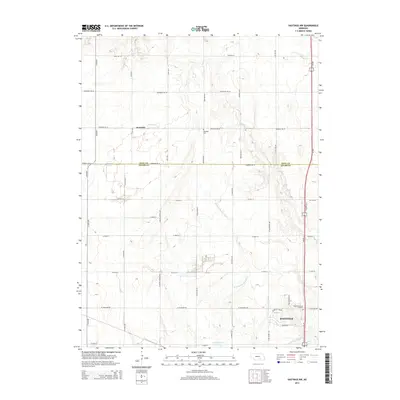
2014 Map of Hastings NW
USGS Topo · Published 2014About this map
W Fork Big Blue River and Flat Cr cross this Nebraska landscape where the northern outskirts of Hastings meet the rural expanses of the Hall Co and Adams Co border. The map captures a transition from organized grid roads like Alda Ave and N Highland Rd to significant local landmarks including the Hastings Nw Reservoir. Genealogists and local historians will find the Rosedale Cem near the small settlement of Rosedale and Sunset Memorial Gardens further south, providing specific points of interest for family research. The dominance of section-line roads such as Rosedale Rd W and Rainforth Rd W illustrates the enduring impact of the Public Land Survey System on the development of central Nebraska's agricultural and residential layout.
Find a feature on this map
41 named features on this map. Tap any name to fly to it.
Don’t see what you’re looking for? This feature index may not catch every label — zoom into the map to look around manually.
Map Details
Editions of this 2014 Hastings NW Map
This is the sole edition of this map. No revisions or reprints were ever made.
Other maps of this area

1892 · Grand Island
USGS Topo · 1:62,500

1894 · Kenesaw
USGS Topo · 1:62,500

1895 · Grand Island
USGS Topo · 1:62,500

1895 · Wood River
USGS Topo · 1:62,500

1896 · Wood River
USGS Topo · 1:125,000

1898 · Grand Island
USGS Topo · 1:125,000

1955 · Grand Island
USGS Topo · 1:250,000

1957 · Grand Island
USGS Topo · 1:250,000

1958 · Grand Island
USGS Topo · 1:250,000

1962 · Prosser
USGS Topo · 1:24,000