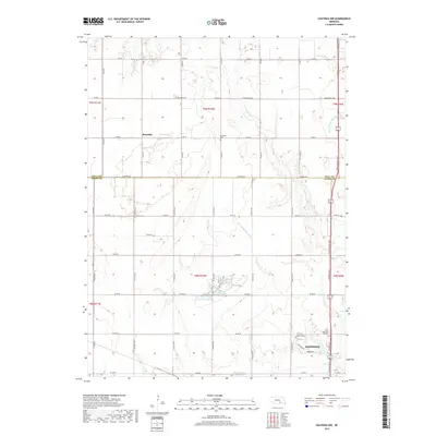
2017 Map of Hastings NW
USGS Topo · Published 2017About this map
The agrarian landscape of the Hall Co Adams Co border is defined by the drainage of the W Fork Big Blue River and its tributaries, including Flat Cr and Beaver Cr. At the southern edge of the map, the expanding northern outskirts of Hastings reach into the rural township, anchored by the Sunset Memorial Gardens and the Hastings Nw Reservoir. To the north, the small settlement of Rosedale serves as a local landmark alongside the Rosedale Cem. The transportation network is dominated by the modern Tom Osborne Expy, which cuts a straight north-south path through the eastern sections, contrasting with the established county road grid that services the surrounding farms and the Kernan Lagoon.
Find a feature on this map
36 named features on this map. Tap any name to fly to it.
Don’t see what you’re looking for? This feature index may not catch every label — zoom into the map to look around manually.
Map Details
Editions of this 2017 Hastings NW Map
This is the sole edition of this map. No revisions or reprints were ever made.
Other maps of this area

1892 · Grand Island
USGS Topo · 1:62,500

1894 · Kenesaw
USGS Topo · 1:62,500

1895 · Grand Island
USGS Topo · 1:62,500

1895 · Wood River
USGS Topo · 1:62,500

1896 · Wood River
USGS Topo · 1:125,000

1898 · Grand Island
USGS Topo · 1:125,000

1955 · Grand Island
USGS Topo · 1:250,000

1957 · Grand Island
USGS Topo · 1:250,000

1958 · Grand Island
USGS Topo · 1:250,000

1962 · Prosser
USGS Topo · 1:24,000