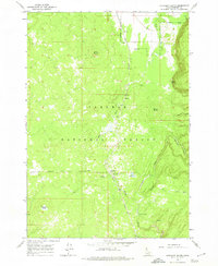
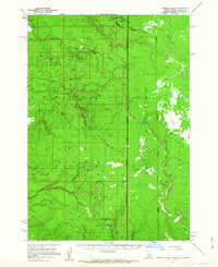
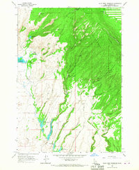
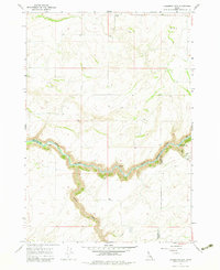
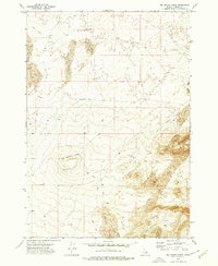
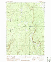
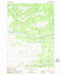
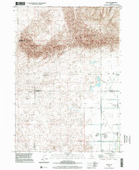
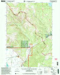
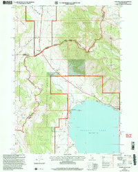
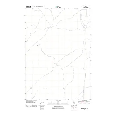
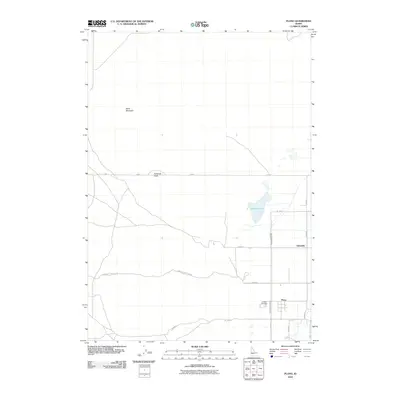
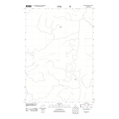
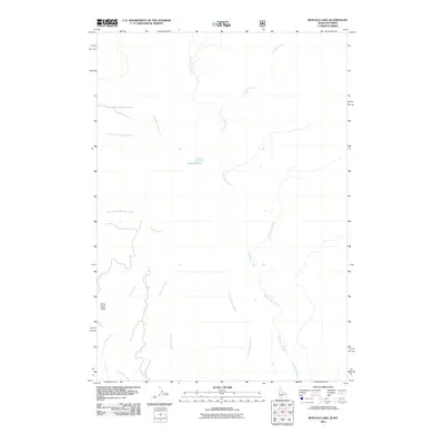
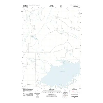
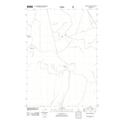
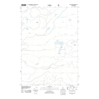
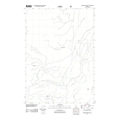
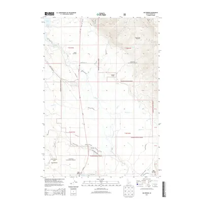
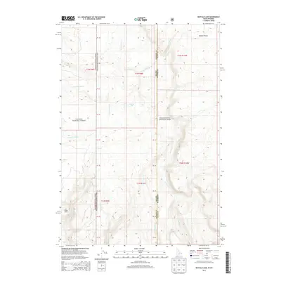
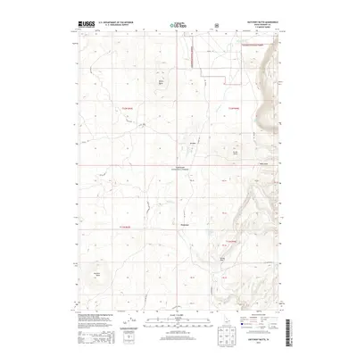
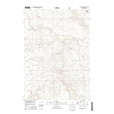
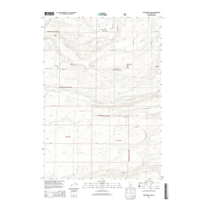
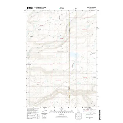
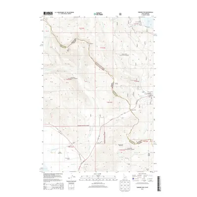
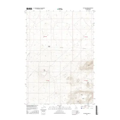
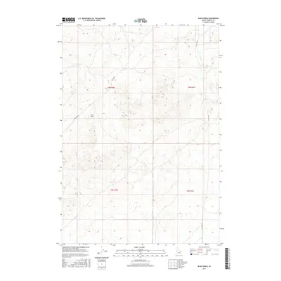
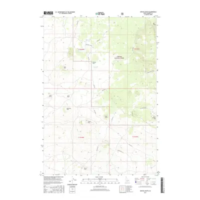
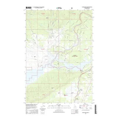
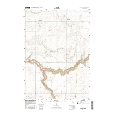
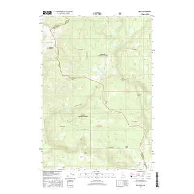
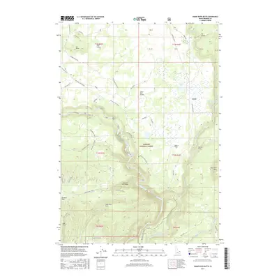
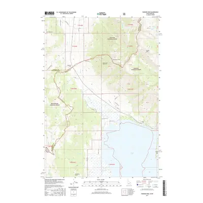
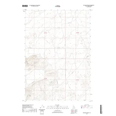
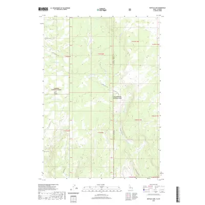
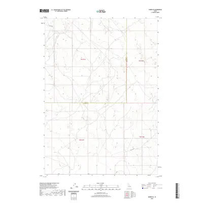
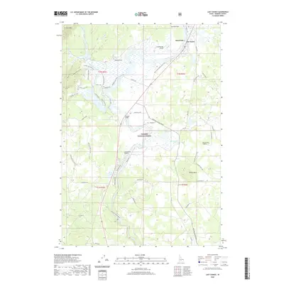
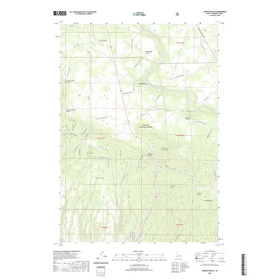
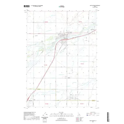
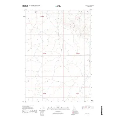
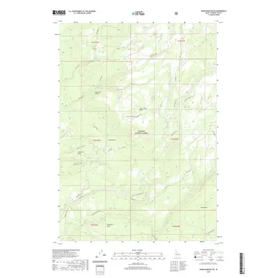
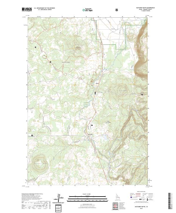
1964 Map of Hatchery Butte
USGS Topo · Published 1974About this map
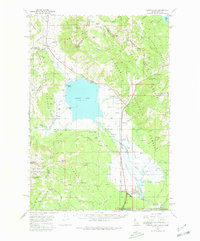
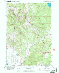
The Union Pacific railroad corridor defines the central axis of this landscape within the Targhee National Forest in the mid-1960s. The tracks pass through the small settlement of Eccles and south toward Pineview, where a nearby Campground indicates the area's development for recreation. The topography is marked by prominent volcanic features, including Ripley Butte, Eccles Butte, and the namesake Hatchery Butte in the southwest corner.
Find a feature on this map
19 named features on this map. Tap any name to fly to it.
Don’t see what you’re looking for? This feature index may not catch every label — zoom into the map to look around manually.
Map Details
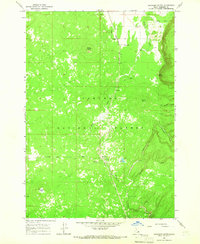
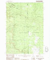
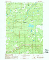
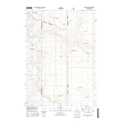
Editions of this 1964 Hatchery Butte Map
2 editions found
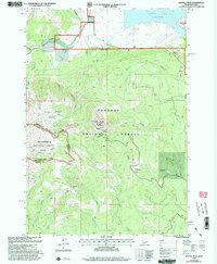
Historical Maps of Fremont County Through Time
196 maps found
1950 St Anthony
Fremont County, ID
1951 Plano
Fremont County, ID
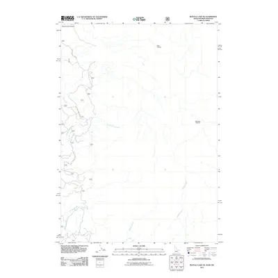
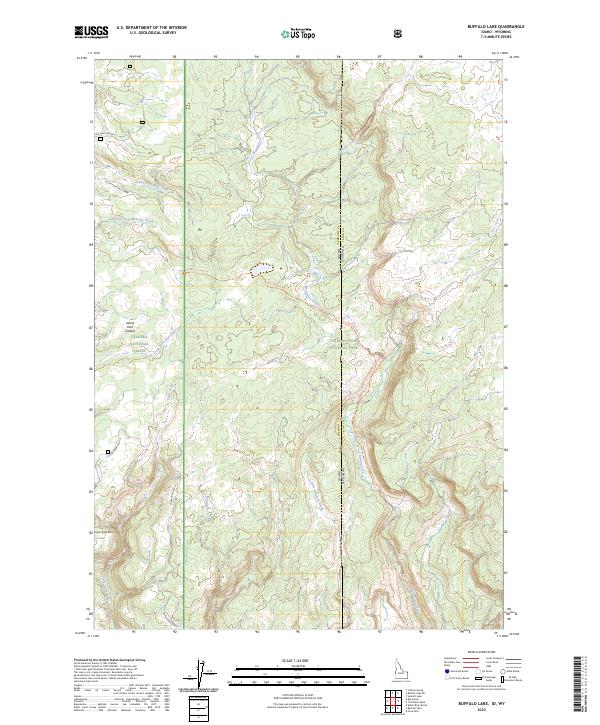
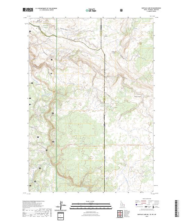
1957 Buffalo Lake
Fremont County, ID
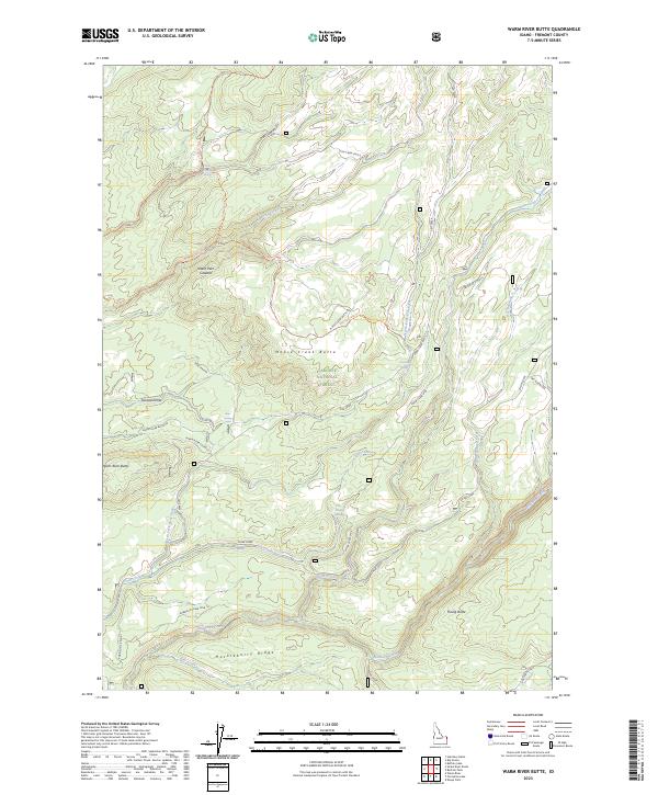
1957 Warm River Butte
Fremont County, ID
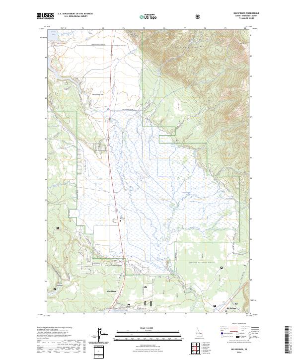
1964 Big Springs
Fremont County, ID
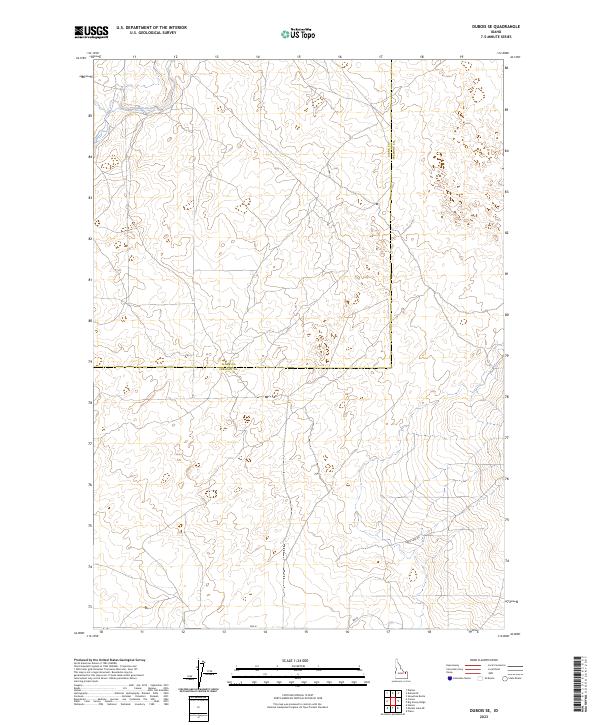
1964 Dubois SE
Fremont County, ID
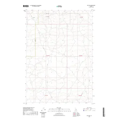
1964 Hatchery Butte
Fremont County, ID
1964 Henrys Lake
Fremont County, ID
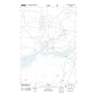
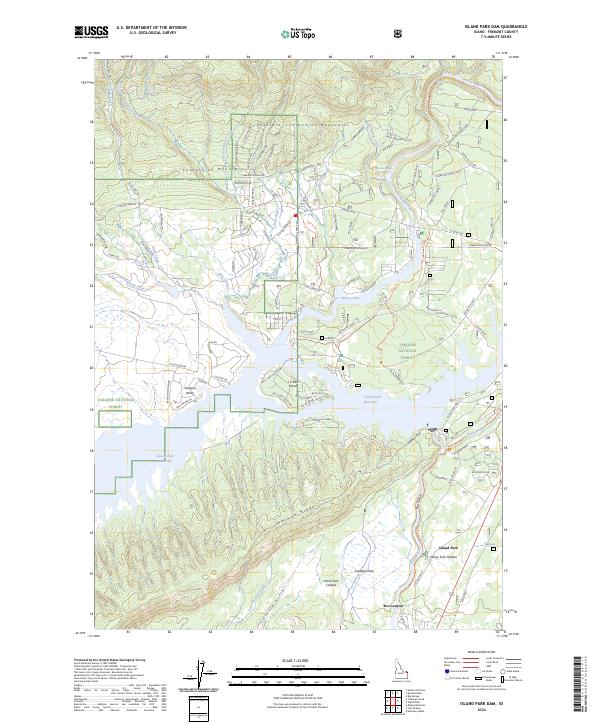
1964 Island Park Dam
Fremont County, ID
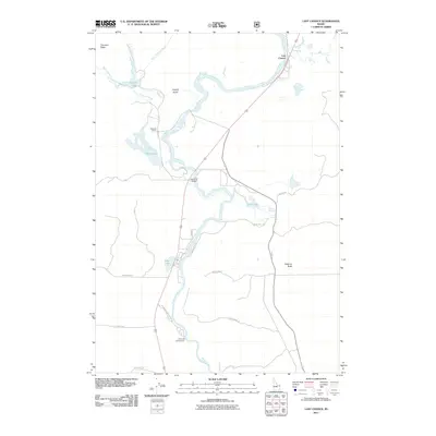
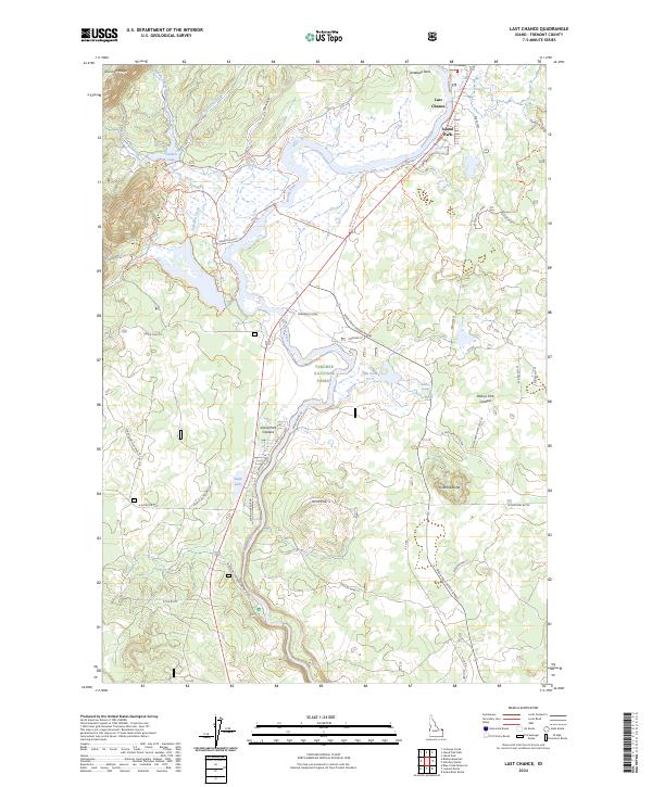
1964 Last Chance
Fremont County, ID
1964 Sawtell PK
Fremont County, ID
1964 Targhee Pass
Fremont County, ID
1964 Targhee Peak
Fremont County, ID
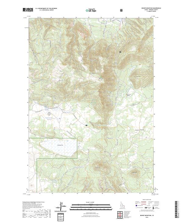
1965 Bishop Mountain
Fremont County, ID
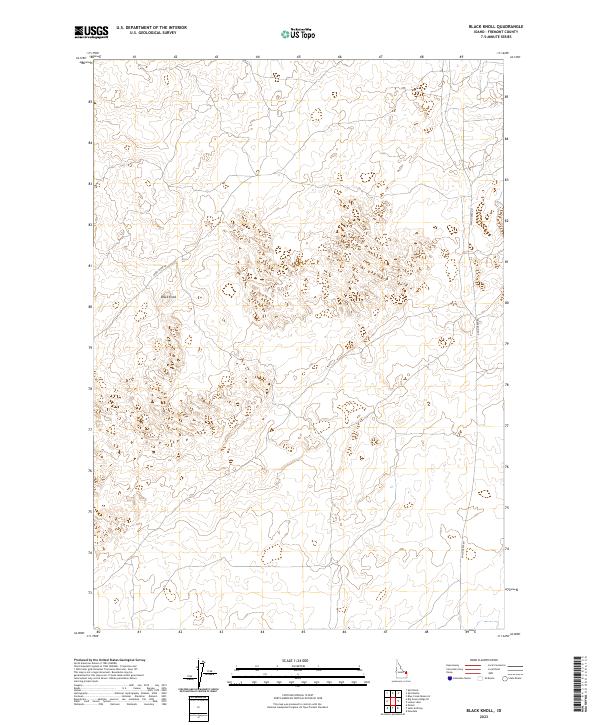
1965 Black Knoll
Fremont County, ID
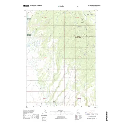
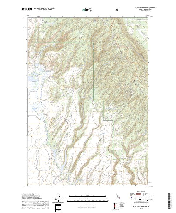
1965 Blue Creek Reservoir
Fremont County, ID
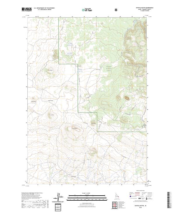
1965 Crystal Butte
Fremont County, ID
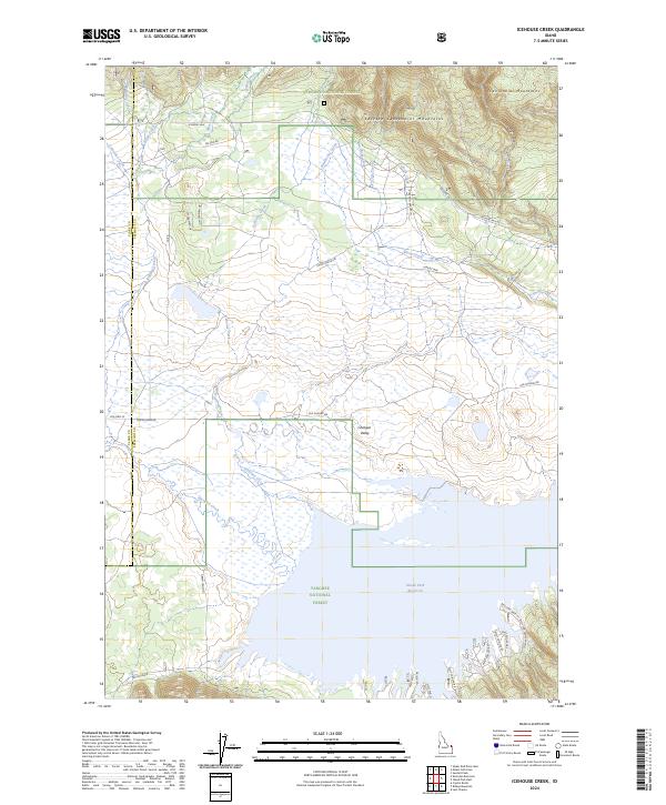
1965 Icehouse Creek
Fremont County, ID
1965 Lemon Lake
Fremont County, ID
1965 Linderman Dam
Fremont County, ID
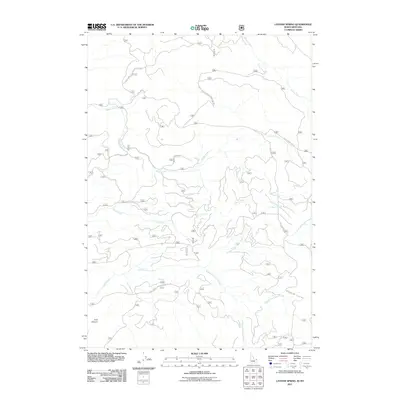
1965 Lookout Butte
Fremont County, ID
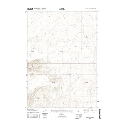
1965 Snake River Butte
Fremont County, ID
1965 Split Butte
Fremont County, ID
1972 Big Grassy Ridge
Fremont County, ID
1972 Big Grassy Ridge SE
Fremont County, ID
1972 Split Rock
Fremont County, ID
1986 Big Grassy
Fremont County, ID
1986 Buffalo Lake
Fremont County, ID
1986 Buffalo Lake NE
Fremont County, ID
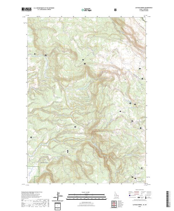
1986 Latham Spring
Fremont County, ID
1986 Reas Pass
Fremont County, ID
1989 Porcupine Lake
Fremont County, ID
1989 Sheep Falls
Fremont County, ID
1989 Warm River Butte
Fremont County, ID
1997 Sawtell Peak
Fremont County, ID
1998 Plano
Fremont County, ID
2000 Buffalo Lake NE
Fremont County, ID
2000 Latham Spring
Fremont County, ID
2000 Reas Pass
Fremont County, ID
2000 Targhee Pass
Fremont County, ID
2000 Targhee Peak
Fremont County, ID
2010 Big Grassy Ridge
Fremont County, ID
2010 Big Grassy Ridge SE
Fremont County, ID
2010 Black Knoll
Fremont County, ID
2010 Dubois SE
Fremont County, ID
2010 Lemon Lake
Fremont County, ID
2010 Linderman Dam
Fremont County, ID
2010 Plano
Fremont County, ID
2010 Saint Anthony
Fremont County, ID
2010 Split Butte
Fremont County, ID
2010 Split Rock
Fremont County, ID
2011 Big Grassy
Fremont County, ID
2011 Big Springs
Fremont County, ID
2011 Bishop Mountain
Fremont County, ID
2011 Blue Creek Reservoir
Fremont County, ID
2011 Buffalo Lake
Fremont County, ID
2011 Buffalo Lake NE
Fremont County, ID
2011 Crystal Butte
Fremont County, ID
2011 Hatchery Butte
Fremont County, ID
2011 Icehouse Creek
Fremont County, ID
2011 Island Park Dam
Fremont County, ID
2011 Last Chance
Fremont County, ID
2011 Latham Spring
Fremont County, ID
2011 Lookout Butte
Fremont County, ID
2011 Porcupine Lake
Fremont County, ID
2011 Reas Pass
Fremont County, ID
2011 Sawtell Peak
Fremont County, ID
2011 Sheep Falls
Fremont County, ID
2011 Snake River Butte
Fremont County, ID
2011 Targhee Pass
Fremont County, ID
2011 Targhee Peak
Fremont County, ID
2011 Warm River Butte
Fremont County, ID
2013 Big Grassy
Fremont County, ID
2013 Big Grassy Ridge
Fremont County, ID
2013 Big Grassy Ridge SE
Fremont County, ID
2013 Big Springs
Fremont County, ID
2013 Bishop Mountain
Fremont County, ID
2013 Black Knoll
Fremont County, ID
2013 Blue Creek Reservoir
Fremont County, ID
2013 Buffalo Lake
Fremont County, ID
2013 Buffalo Lake NE
Fremont County, ID
2013 Crystal Butte
Fremont County, ID
2013 Dubois SE
Fremont County, ID
2013 Hatchery Butte
Fremont County, ID
2013 Icehouse Creek
Fremont County, ID
2013 Island Park Dam
Fremont County, ID
2013 Last Chance
Fremont County, ID
2013 Latham Spring
Fremont County, ID
2013 Lemon Lake
Fremont County, ID
2013 Linderman Dam
Fremont County, ID
2013 Lookout Butte
Fremont County, ID

2013 Plano
Fremont County, ID
2013 Porcupine Lake
Fremont County, ID
2013 Reas Pass
Fremont County, ID
2013 Saint Anthony
Fremont County, ID
2013 Sawtell Peak
Fremont County, ID
2013 Sheep Falls
Fremont County, ID
2013 Snake River Butte
Fremont County, ID
2013 Split Butte
Fremont County, ID
2013 Split Rock
Fremont County, ID
2013 Targhee Pass
Fremont County, ID
2013 Targhee Peak
Fremont County, ID
2013 Warm River Butte
Fremont County, ID
2017 Big Grassy
Fremont County, ID
2017 Big Grassy Ridge
Fremont County, ID
2017 Big Grassy Ridge SE
Fremont County, ID
2017 Big Springs
Fremont County, ID
2017 Bishop Mountain
Fremont County, ID
2017 Black Knoll
Fremont County, ID
2017 Blue Creek Reservoir
Fremont County, ID
2017 Buffalo Lake
Fremont County, ID
2017 Buffalo Lake NE
Fremont County, ID
2017 Crystal Butte
Fremont County, ID
2017 Dubois SE
Fremont County, ID
2017 Hatchery Butte
Fremont County, ID
2017 Icehouse Creek
Fremont County, ID
2017 Island Park Dam
Fremont County, ID
2017 Last Chance
Fremont County, ID
2017 Latham Spring
Fremont County, ID
2017 Lemon Lake
Fremont County, ID
2017 Linderman Dam
Fremont County, ID
2017 Lookout Butte
Fremont County, ID
2017 Plano
Fremont County, ID
2017 Porcupine Lake
Fremont County, ID
2017 Reas Pass
Fremont County, ID
2017 Saint Anthony
Fremont County, ID
2017 Sawtell Peak
Fremont County, ID
2017 Sheep Falls
Fremont County, ID
2017 Snake River Butte
Fremont County, ID
2017 Split Butte
Fremont County, ID
2017 Split Rock
Fremont County, ID
2017 Targhee Pass
Fremont County, ID
2017 Targhee Peak
Fremont County, ID
2017 Warm River Butte
Fremont County, ID
2020 Big Grassy
Fremont County, ID
2020 Big Grassy Ridge
Fremont County, ID
2020 Big Grassy Ridge SE
Fremont County, ID
2020 Big Springs
Fremont County, ID
2020 Bishop Mountain
Fremont County, ID
2020 Black Knoll
Fremont County, ID
2020 Blue Creek Reservoir
Fremont County, ID
2020 Buffalo Lake
Fremont County, ID
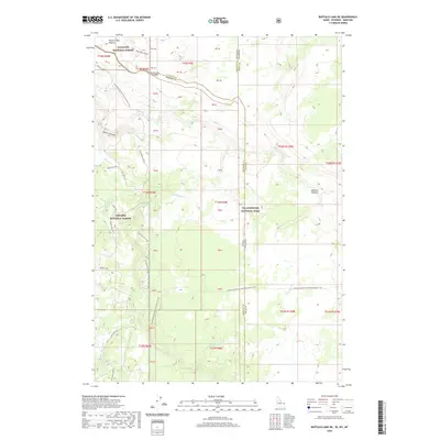
2020 Buffalo Lake NE
Fremont County, ID
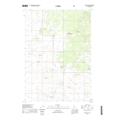
2020 Crystal Butte
Fremont County, ID
2020 Dubois SE
Fremont County, ID
2020 Hatchery Butte
Fremont County, ID
2020 Icehouse Creek
Fremont County, ID
2020 Island Park Dam
Fremont County, ID
2020 Last Chance
Fremont County, ID
2020 Latham Spring
Fremont County, ID
2020 Lemon Lake
Fremont County, ID
2020 Linderman Dam
Fremont County, ID
2020 Lookout Butte
Fremont County, ID
2020 Plano
Fremont County, ID
2020 Porcupine Lake
Fremont County, ID
2020 Reas Pass
Fremont County, ID
2020 Saint Anthony
Fremont County, ID
2020 Sawtell Peak
Fremont County, ID
2020 Sheep Falls
Fremont County, ID
2020 Snake River Butte
Fremont County, ID
2020 Split Butte
Fremont County, ID
2020 Split Rock
Fremont County, ID
2020 Targhee Pass
Fremont County, ID
2020 Targhee Peak
Fremont County, ID
2020 Warm River Butte
Fremont County, ID
2023 Big Grassy
Fremont County, ID
2023 Big Grassy Ridge
Fremont County, ID
2023 Big Grassy Ridge SE
Fremont County, ID
2023 Bishop Mountain
Fremont County, ID
2023 Black Knoll
Fremont County, ID
2023 Blue Creek Reservoir
Fremont County, ID
2023 Buffalo Lake
Fremont County, ID
2023 Buffalo Lake NE
Fremont County, ID
2023 Dubois SE
Fremont County, ID
2023 Hatchery Butte
Fremont County, ID
2023 Latham Spring
Fremont County, ID
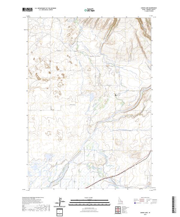
2023 Lemon Lake
Fremont County, ID
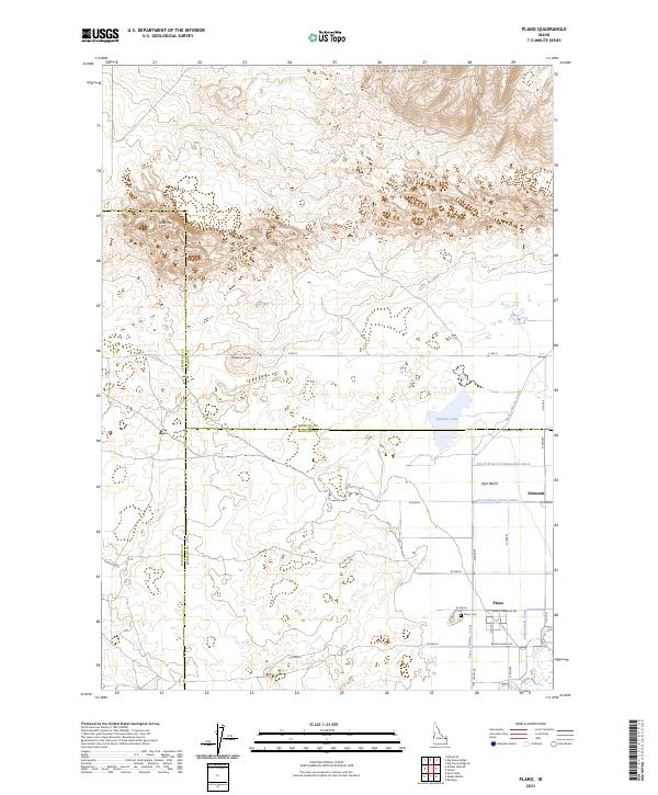
2023 Plano
Fremont County, ID
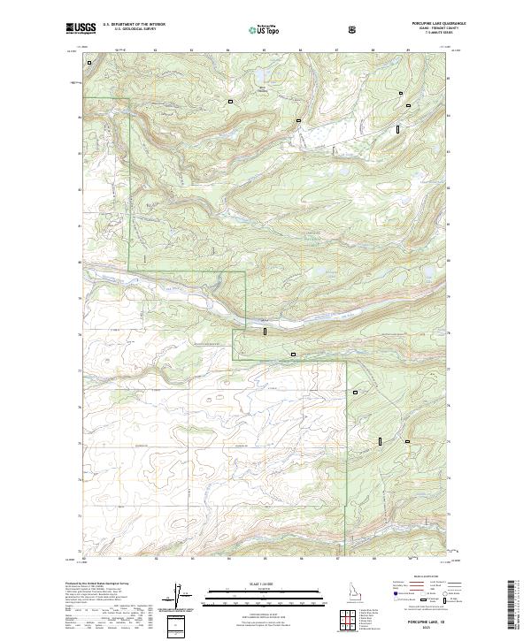
2023 Porcupine Lake
Fremont County, ID
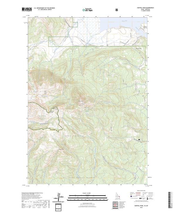
2023 Sawtell Peak
Fremont County, ID
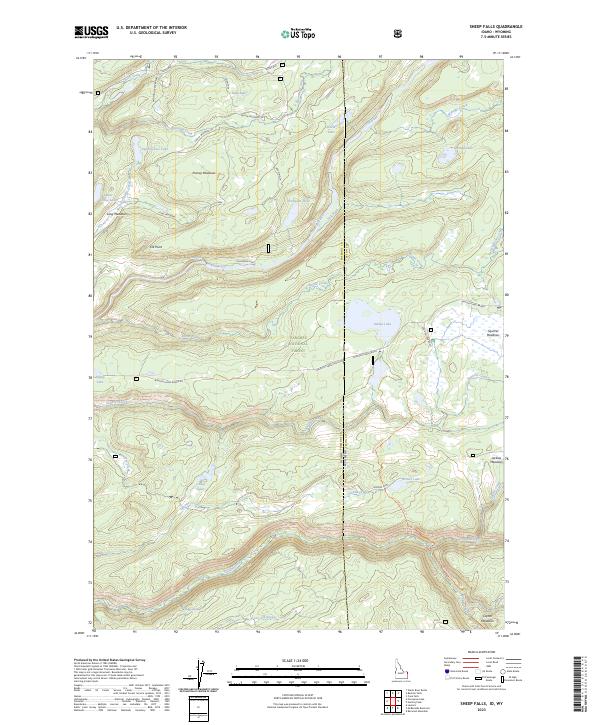
2023 Sheep Falls
Fremont County, ID
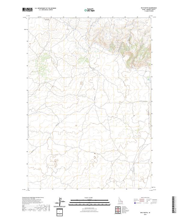
2023 Split Butte
Fremont County, ID
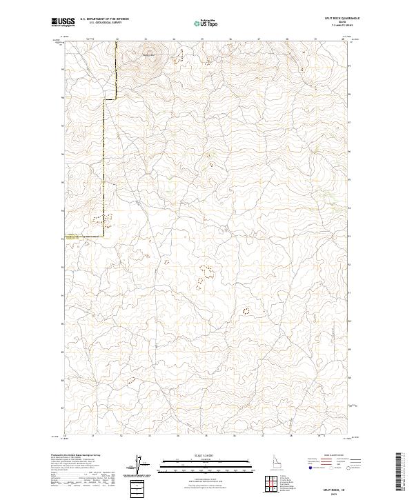
2023 Split Rock
Fremont County, ID
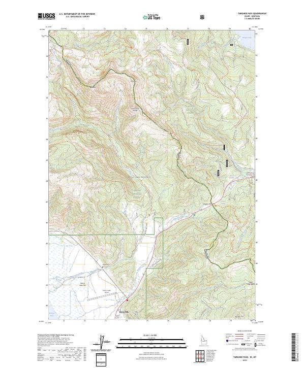
2023 Targhee Pass
Fremont County, ID
2023 Warm River Butte
Fremont County, ID
2024 Big Springs
Fremont County, ID
2024 Crystal Butte
Fremont County, ID
2024 Icehouse Creek
Fremont County, ID
2024 Island Park Dam
Fremont County, ID
2024 Last Chance
Fremont County, ID
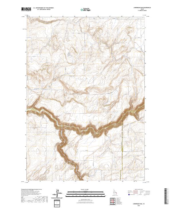
2024 Linderman Dam
Fremont County, ID
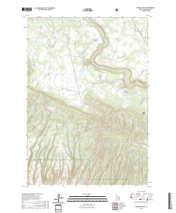
2024 Lookout Butte
Fremont County, ID
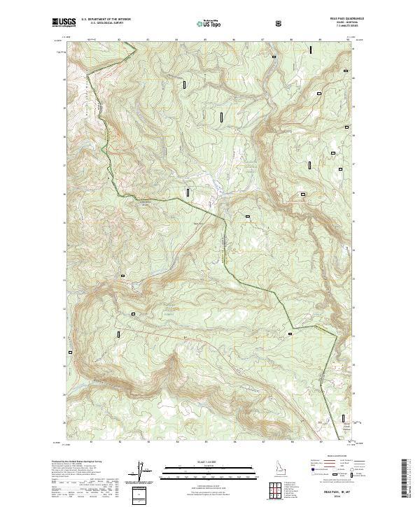
2024 Reas Pass
Fremont County, ID
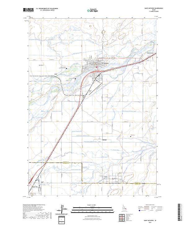
2024 Saint Anthony
Fremont County, ID
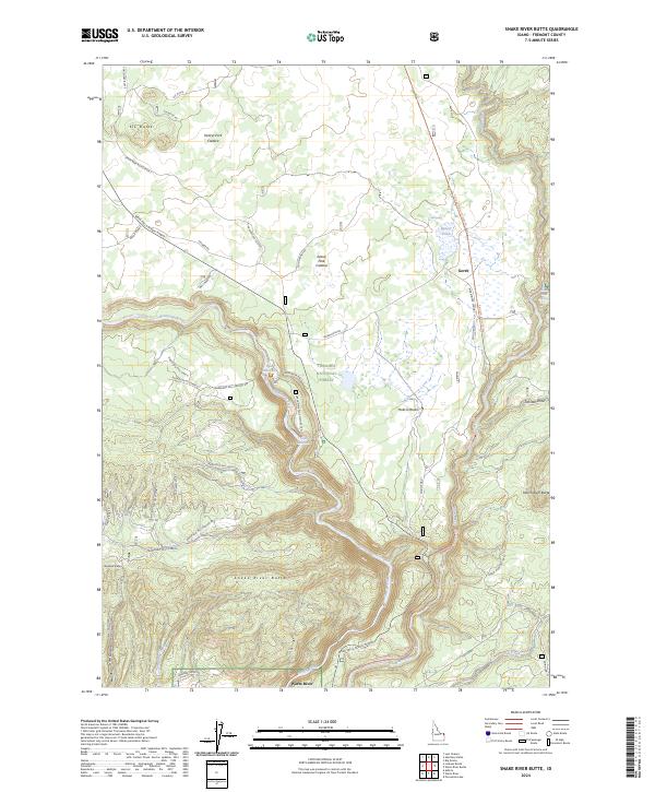
2024 Snake River Butte
Fremont County, ID
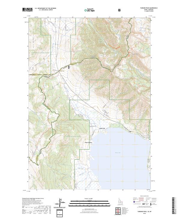
2024 Targhee Peak
Fremont County, ID