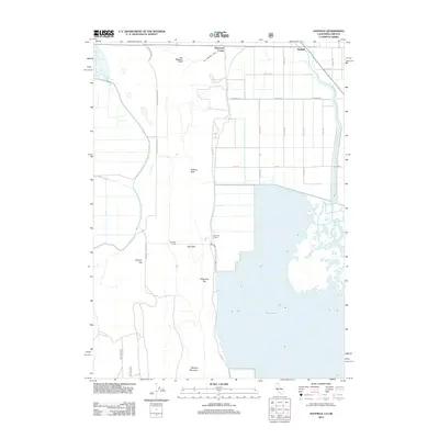
2012 Map of Hatfield
USGS Topo · Published 2012About this map
The State Line Rd corridor defines the northern edge of this landscape, where the border between California and Oregon meets the agricultural and volcanic terrain of the Klamath Basin. Hatfield sits at the intersection of early twentieth-century irrigation engineering and interstate commerce, positioned just north of the expansive Tule Lake. The importance of water management in this arid region is visible through the Van Brimmer Canal and the Tule Lake Tunnel, infrastructure that transformed the basin floor into productive acreage like Winema Farms.
Find a feature on this map
24 named features on this map. Tap any name to fly to it.
Don’t see what you’re looking for? This feature index may not catch every label — zoom into the map to look around manually.
Map Details
Editions of this 2012 Hatfield Map
This is the sole edition of this map. No revisions or reprints were ever made.
Other maps of this area

1886 · Modoc Lava Bed
USGS Topo · 1:250,000

1889 · Klamath
USGS Topo · 1:250,000

1892 · Modoc Lava-Bed
USGS Topo · 1:250,000

1894 · Klamath
USGS Topo · 1:250,000

1950 · Mt. Dome
USGS Topo · 1:62,500

1951 · Tulelake
USGS Topo · 1:62,500

1954 · Alturas
USGS Topo · 1:250,000

1955 · Klamath Falls
USGS Topo · 1:250,000

1957 · Merrill
USGS Topo · 1:62,500

1957 · Malin
USGS Topo · 1:62,500