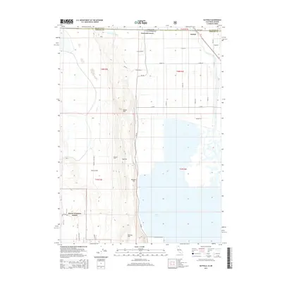
2015 Map of Hatfield
USGS Topo · Published 2015About this map
Hatfield sits at the intersection of the Oregon-California state line and the Klamath-Siskiyou county boundaries, serving as a focal point for this high-desert agricultural and wildlife landscape. The terrain is defined by the dramatic north-south rise of Sheepy Ridge, which reaches its heights at Sheepy Peak and High Rim, overlooking the vast reclaimed basins of Tule Lake.
Find a feature on this map
33 named features on this map. Tap any name to fly to it.
Don’t see what you’re looking for? This feature index may not catch every label — zoom into the map to look around manually.
Map Details
Editions of this 2015 Hatfield Map
This is the sole edition of this map. No revisions or reprints were ever made.
Other maps of this area

1886 · Modoc Lava Bed
USGS Topo · 1:250,000

1889 · Klamath
USGS Topo · 1:250,000

1892 · Modoc Lava-Bed
USGS Topo · 1:250,000

1894 · Klamath
USGS Topo · 1:250,000

1950 · Mt. Dome
USGS Topo · 1:62,500

1951 · Tulelake
USGS Topo · 1:62,500

1954 · Alturas
USGS Topo · 1:250,000

1955 · Klamath Falls
USGS Topo · 1:250,000

1957 · Merrill
USGS Topo · 1:62,500

1957 · Malin
USGS Topo · 1:62,500