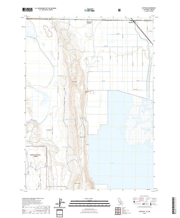
2022 Map of Hatfield
USGS Topo · Published 2022About this map
Hatfield straddles the boundary between California and Oregon, serving as a focal point for this reclaimed agricultural and wildlife landscape. The area is defined by the extensive waters of Tule Lake and the managed flow of the Lost River and Van Brimmer Canal, which support both the local farming economy and the surrounding conservation lands. Significant portions of the territory are dedicated to the Tule Lake National Wildlife Refuge and the Lower Klamath National Wildlife Refuge, where the flat marshlands contrast sharply with the rising elevations of Sheepy Peak and the High Rim. To the south, the topography transitions toward the timbered slopes of the Modoc National Forest. Smaller settlements like Ainsworth Corner and family-named landmarks such as Barntop Mtn provide essential reference points for researchers studying the land-use patterns of the Klamath Basin.
Find a feature on this map
39 named features on this map. Tap any name to fly to it.
Don’t see what you’re looking for? This feature index may not catch every label — zoom into the map to look around manually.
Map Details
Editions of this 2022 Hatfield Map
This is the sole edition of this map. No revisions or reprints were ever made.
Other maps of this area

1886 · Modoc Lava Bed
USGS Topo · 1:250,000

1889 · Klamath
USGS Topo · 1:250,000

1892 · Modoc Lava-Bed
USGS Topo · 1:250,000

1894 · Klamath
USGS Topo · 1:250,000

1950 · Mt. Dome
USGS Topo · 1:62,500

1951 · Tulelake
USGS Topo · 1:62,500

1954 · Alturas
USGS Topo · 1:250,000

1955 · Klamath Falls
USGS Topo · 1:250,000

1957 · Merrill
USGS Topo · 1:62,500

1957 · Malin
USGS Topo · 1:62,500