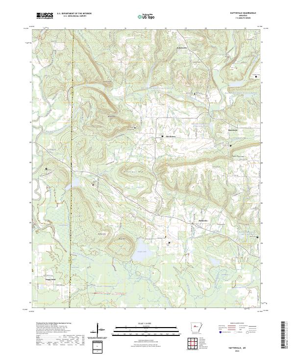
2024 Map of Hattieville
USGS Topo · Published 2024About this map
Hattieville and surrounding settlements like Robertsville and Old Hickory anchor this part of Conway County, where the landscape is defined by the winding course of West Fork Point Remove Creek. The terrain is punctuated by significant rises such as Wildcat Mtn and Pigeon Roost Mtn, which overlook a network of rural roads and water management sites including the West Fork Point Remove Cr Site 12 Reservoir. Genealogists will find a high density of family-named landmarks and burial grounds, from the Childers Cem in the west to the Dunham Cem in the northeast corner near the Candy Branch. The southern portion of the map transitions into the flatter terrain of Happy Bend near Goose Pond, illustrating the shift from the higher elevations of Devils Knob and Wiedower Mtn down toward the creek bottomlands.
Find a feature on this map
92 named features on this map. Tap any name to fly to it.
Don’t see what you’re looking for? This feature index may not catch every label — zoom into the map to look around manually.
Map Details
Editions of this 2024 Hattieville Map
This is the sole edition of this map. No revisions or reprints were ever made.
Other maps of this area

1889 · Morrilton No. 3
USGS Topo · 1:62,500

1892 · Morrillton
USGS Topo · 1:125,000

1894 · Morrillton
USGS Topo · 1:125,000

1956 · Russellville
USGS Topo · 1:250,000

1961 · Morrilton East
USGS Topo · 1:24,000

1961 · Morrilton West
USGS Topo · 1:24,000

1961 · Atkins
USGS Topo · 1:24,000
1962 · Hector
USGS Topo · 1:24,000
1962 · Jerusalem
USGS Topo · 1:24,000
1962 · Cleveland
USGS Topo · 1:24,000