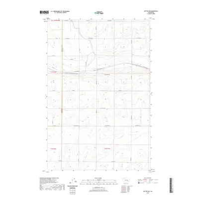
2020 Map of Hatton NW
USGS Topo · Published 2020About this map
The Palouse To Cascades State Park Trail carves a straight path across the central landscape, following the corridor of the former Milwaukee Road railroad line. This prominent trail serves as a major geographical landmark in this section of the Columbia Basin, crossing the East Low Canal which provides critical irrigation to the surrounding agricultural fields. The map reveals a highly structured grid of section roads, including W Lind-Warden Rd and W Providence Rd, which define the agricultural plots of this rural territory. The boundary between Grant and Adams Counties runs north-to-south through the western portion of the sheet, highlighting the administrative division of this high-desert farming region during the modern era.
Find a feature on this map
25 named features on this map. Tap any name to fly to it.
Don’t see what you’re looking for? This feature index may not catch every label — zoom into the map to look around manually.
Map Details
Editions of this 2020 Hatton NW Map
This is the sole edition of this map. No revisions or reprints were ever made.
Other maps of this area

1916 · Connell
USGS Topo · 1:125,000

1918 · Connell
USGS Topo · 1:125,000

1923 · Wheeler
USGS Topo · 1:62,500

1924 · Othello
USGS Topo · 1:62,500

1925 · Wheeler
USGS Topo · 1:62,500

1925 · Schrag
USGS Topo · 1:62,500

1953 · Walla Walla
USGS Topo · 1:250,000

1953 · Ritzville
USGS Topo · 1:250,000

1954 · Bruce
USGS Topo · 1:24,000

1954 · Warden
USGS Topo · 1:24,000