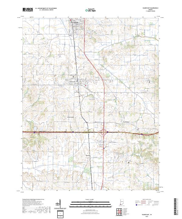
2022 Map of Haubstadt
USGS Topo · Published 2022About this map
Haubstadt and Fort Branch anchor this southwestern Indiana landscape, where the agricultural grid is intersected by the historic transit corridors of the CSX railroad and modern highways. The terrain is defined by the subtle drainage patterns of the W Fork Pigeon Cr and Hurricane Cr, alongside man-made alterations like the Pond Flat Ditch. This 2022 survey captures the persistent rural character of the border between Gibson and Vanderburgh counties, documenting the placement of small community centers like Saint James and Warrenton. Local genealogy is well-served by the clear labeling of parish and family-named burial grounds, including Saints Peter and Paul Cem and the Stunkel Cem. The map reveals a highly structured environment where legacy farm roads like Co RD 1000 S and W State Rd 68 continue to define the movement of people across these tillable acres.
Find a feature on this map
44 named features on this map. Tap any name to fly to it.
Don’t see what you’re looking for? This feature index may not catch every label — zoom into the map to look around manually.
Map Details
Editions of this 2022 Haubstadt Map
This is the sole edition of this map. No revisions or reprints were ever made.
Other maps of this area

1901 · Princeton
USGS Topo · 1:62,500

1901 · Haubstadt
USGS Topo · 1:62,500

1902 · Ditney
USGS Topo · 1:125,000

1902 · Boonville
USGS Topo · 1:62,500

1903 · Haubstadt
USGS Topo · 1:62,500

1903 · Petersburg
USGS Topo · 1:62,500

1903 · Princeton
USGS Topo · 1:62,500

1903 · Patoka
USGS Topo · 1:125,000

1956 · Vincennes
USGS Topo · 1:250,000

1957 · Vincennes
USGS Topo · 1:250,000