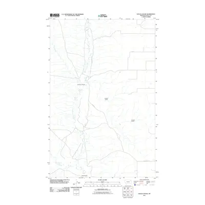
2011 Map of Hauck Coulee
USGS Topo · Published 2011About this map
Little Porcupine Creek meanders through this portion of the Frazer District in Valley County, defining the drainage patterns of this Montana landscape. The area is marked by a series of geographic depressions and seasonal waterways, including the family-named Jack Norris Coulee and O'Watch Coulee. The rural infrastructure is largely centered around a grid of gravel roads such as Granada Rd and Grand Prairie Rd, which provide access to the expansive terrain. To the south, Tomato Can Creek and the namesake Hauck Coulee illustrate the complex hydrography of the region. The map captures a moment of modern land management where traditional natural landmarks like Neufeld Coulee remain central to local identification and navigation.
Find a feature on this map
10 named features on this map. Tap any name to fly to it.
Don’t see what you’re looking for? This feature index may not catch every label — zoom into the map to look around manually.
Map Details
Editions of this 2011 Hauck Coulee Map
This is the sole edition of this map. No revisions or reprints were ever made.
Other maps of this area

1910 · Todd Lakes
USGS Topo · 1:62,500

1915 · Frazer
USGS Topo · 1:62,500

1915 · Oswego
USGS Topo · 1:62,500

1915 · Todd Lakes
USGS Topo · 1:62,500

1915 · Spring Creek
USGS Topo · 1:62,500

1954 · Wolf Point
USGS Topo · 1:250,000

1954 · Glasgow
USGS Topo · 1:250,000

1957 · Glasgow
USGS Topo · 1:250,000

1958 · Wolf Point
USGS Topo · 1:250,000

1958 · Glasgow
USGS Topo · 1:250,000