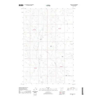
2020 Map of Hauck Coulee
USGS Topo · Published 2020About this map
Jack Norris Coulee and O'Watch Coulee carve through the high plains of Valley County, defining a landscape shaped by intermittent water and deep-cut drainage patterns. This 2020 topographic record shows a sparsely settled region within the townships of T29N and T30N, where travel is dictated by sectional routes like Granada Rd and Grand Prairie Rd. The drainage network is complex, featuring the winding courses of Little Porcupine Cr and the uniquely named Tomato Can Cr. High-altitude water features like Todd Lakes and named draws such as Neufeld Coulee and Johnson Coulee reveal the locations of crucial water sources and local landmarks used by generations of ranchers and land managers in this part of eastern Montana.
Find a feature on this map
16 named features on this map. Tap any name to fly to it.
Don’t see what you’re looking for? This feature index may not catch every label — zoom into the map to look around manually.
Map Details
Editions of this 2020 Hauck Coulee Map
This is the sole edition of this map. No revisions or reprints were ever made.
Other maps of this area

1910 · Todd Lakes
USGS Topo · 1:62,500

1915 · Frazer
USGS Topo · 1:62,500

1915 · Oswego
USGS Topo · 1:62,500

1915 · Todd Lakes
USGS Topo · 1:62,500

1915 · Spring Creek
USGS Topo · 1:62,500

1954 · Wolf Point
USGS Topo · 1:250,000

1954 · Glasgow
USGS Topo · 1:250,000

1957 · Glasgow
USGS Topo · 1:250,000

1958 · Wolf Point
USGS Topo · 1:250,000

1958 · Glasgow
USGS Topo · 1:250,000