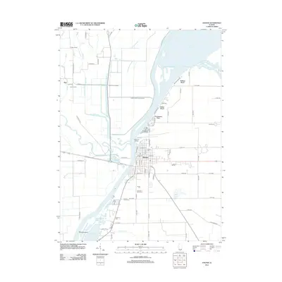
2012 Map of Havana
USGS Topo · Published 2012About this map
Havana anchors this reach of the Illinois River, situated just below the confluence with the Spoon River. The geography is defined by a complex network of waterways and low-lying islands, including the Island of Canton and Matanzas Island. These riverine features, alongside Deep Slough and Cook Harbor, illustrate the area's historical reliance on the river for navigation and commerce. Away from the water, the landscape is marked by numerous family and community burial grounds such as Fullerton Cem, Laurel Hill Cem, and the Hancock-Pioneer Cem, providing a detailed record for genealogical study.
Find a feature on this map
82 named features on this map. Tap any name to fly to it.
Don’t see what you’re looking for? This feature index may not catch every label — zoom into the map to look around manually.
Map Details
Editions of this 2012 Havana Map
This is the sole edition of this map. No revisions or reprints were ever made.
Other maps of this area

1925 · Havana
USGS Topo · 1:62,500

1929 · Manito
USGS Topo · 1:62,500

1930 · Chandlerville
USGS Topo · 1:62,500

1932 · Chandlerville
USGS Topo · 1:62,500

1932 · Manito
USGS Topo · 1:62,500

1933 · Petersburg
USGS Topo · 1:62,500

1938 · Petersburg
USGS Topo · 1:62,500

1947 · Lewistown
USGS Topo · 1:24,000

1947 · St. David
USGS Topo · 1:24,000

1947 · Havana
USGS Topo · 1:24,000