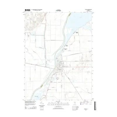
2015 Map of Havana
USGS Topo · Published 2015About this map
Havana serves as the focal point of this Mason County riverfront landscape, positioned where the Spoon River joins the Illinois River from the west. The town’s grid is anchored by E Main St and E Washington St, extending toward the riverfront at Cook Harbor. The surrounding area is defined by a complex network of backwater lakes and sloughs, including the expansive Lake Chautauqua and Quiver Lake to the north, and Matanzas Lake to the south.
Find a feature on this map
89 named features on this map. Tap any name to fly to it.
Don’t see what you’re looking for? This feature index may not catch every label — zoom into the map to look around manually.
Map Details
Editions of this 2015 Havana Map
This is the sole edition of this map. No revisions or reprints were ever made.
Other maps of this area

1925 · Havana
USGS Topo · 1:62,500

1929 · Manito
USGS Topo · 1:62,500

1930 · Chandlerville
USGS Topo · 1:62,500

1932 · Chandlerville
USGS Topo · 1:62,500

1932 · Manito
USGS Topo · 1:62,500

1933 · Petersburg
USGS Topo · 1:62,500

1938 · Petersburg
USGS Topo · 1:62,500

1947 · Lewistown
USGS Topo · 1:24,000

1947 · St. David
USGS Topo · 1:24,000

1947 · Havana
USGS Topo · 1:24,000