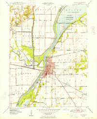
1948 Map of Havana
USGS Topo · Published 1948About this map
Havana sits at the confluence of the Spoon River and the Illinois River, serving as a vital river crossing and rail hub in the late 1940s. The landscape is defined by the engineered control of these waterways, evidenced by the extensive levee systems and the Thompson Lake Pumping Station. To the north, the Chautauqua National Migratory Waterfowl Refuge dominates the valley, bordering Lake Chautauqua.
Find a feature on this map
59 named features on this map. Tap any name to fly to it.
Don’t see what you’re looking for? This feature index may not catch every label — zoom into the map to look around manually.
Map Details
Editions of this 1948 Havana Map
2 editions found
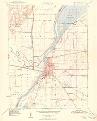
Other maps of this area

1925 · Havana
USGS Topo · 1:62,500

1929 · Manito
USGS Topo · 1:62,500

1930 · Chandlerville
USGS Topo · 1:62,500

1932 · Chandlerville
USGS Topo · 1:62,500

1932 · Manito
USGS Topo · 1:62,500

1933 · Petersburg
USGS Topo · 1:62,500

1938 · Petersburg
USGS Topo · 1:62,500

1947 · Lewistown
USGS Topo · 1:24,000

1947 · St. David
USGS Topo · 1:24,000

1947 · Havana
USGS Topo · 1:24,000