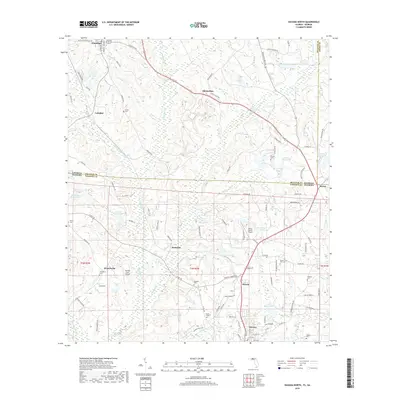
2018 Map of Havana North
USGS Topo · Published 2018About this map
The Georgia-Florida state line bisects this landscape, separating the agriculture and creek basins of Decatur and Grady Counties from northern Gadsden County. In the Florida portion, the settlement of Havana anchors the southern edge, connected to northern outposts like Jamieson and Hinson via a network of rural roads such as Co Rd 159. The terrain is defined by the drainage of Attapulgus Cr and the Ochlockonee River, which creates a complex pattern of wetlands and named ponds including Frank Smith Pond and Gute Chester Pond. Numerous family and community cemeteries, such as Shelfer Cem and Griffin Cem, are scattered across the landscape, providing essential touchpoints for genealogical research in this long-settled borderland. Small aviation facilities like Saranac Farm Airport and Peavy Farms Airport reflect the modern utility of these large landholdings in a region still primarily dedicated to agriculture and forestry.
Find a feature on this map
109 named features on this map. Tap any name to fly to it.
Don’t see what you’re looking for? This feature index may not catch every label — zoom into the map to look around manually.
Map Details
Editions of this 2018 Havana North Map
This is the sole edition of this map. No revisions or reprints were ever made.
Other maps of this area

1954 · Tallahassee
USGS Topo · 1:250,000

1955 · Bainbridge
USGS Topo · 1:62,500

1955 · Whigham
USGS Topo · 1:62,500

1956 · Havana North
USGS Topo · 1:24,000

1956 · Dogtown
USGS Topo · 1:24,000

1956 · Calvary
USGS Topo · 1:24,000

1959 · Tallahassee
USGS Topo · 1:250,000

1959 · Quincy
USGS Topo · 1:24,000

1960 · Tallahassee
USGS Topo · 1:250,000

1963 · Lake Jackson
USGS Topo · 1:24,000