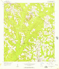
1956 Map of Havana North
USGS Topo · Published 1957About this map
Havana and Attapulgus anchor this mid-century survey of the borderlands between Georgia and Florida. The landscape is defined by the winding course of Attapulgus Creek and its many tributaries, including Miller Branch and Gum Branch, which carve through the terrain. The presence of the Seaboard Air Line railroad facilitates transport between small agricultural and timber settlements like Jamieson, Hinson, and Amsterdam.
Find a feature on this map
35 named features on this map. Tap any name to fly to it.
Don’t see what you’re looking for? This feature index may not catch every label — zoom into the map to look around manually.
Map Details
Editions of this 1956 Havana North Map
2 editions found
Other maps of this area

1954 · Tallahassee
USGS Topo · 1:250,000

1955 · Bainbridge
USGS Topo · 1:62,500

1955 · Whigham
USGS Topo · 1:62,500

1956 · Havana North
USGS Topo · 1:24,000

1956 · Dogtown
USGS Topo · 1:24,000

1956 · Calvary
USGS Topo · 1:24,000

1959 · Tallahassee
USGS Topo · 1:250,000

1959 · Quincy
USGS Topo · 1:24,000

1960 · Tallahassee
USGS Topo · 1:250,000

1963 · Lake Jackson
USGS Topo · 1:24,000