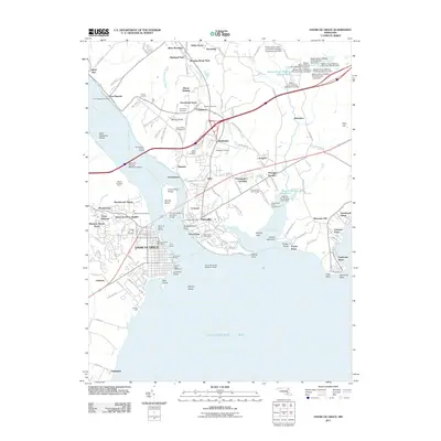
2011 Map of Havre De Grace
USGS Topo · Published 2011About this map
The Susquehanna River flows into the Chesapeake Bay at this critical historical junction, where the twin port towns of Havre De Grace and Perryville face each other across the water. The landscape is defined by its maritime and industrial legacy, featuring the Concord Point Lighthouse and the Havre de Grace Marina alongside the massive spans of the Millard E Tydings Memorial Bridge and the Thomas Hatem Memorial Bridge. To the north, the industrial heritage of the region is evident at Principio Furnace and the McClenahan Granite Quarry. Numerous residential developments like Meadowvale and Highland Park illustrate the modern suburban growth of Harford and Cecil Counties. Local history is preserved in sites such as Mount Erin Cemetery and the Veterans Affairs grounds at Perry Point, while Garrett Island stands as a prominent natural landmark in the river's mouth.
Find a feature on this map
83 named features on this map. Tap any name to fly to it.
Don’t see what you’re looking for? This feature index may not catch every label — zoom into the map to look around manually.
Map Details
Editions of this 2011 Havre De Grace Map
This is the sole edition of this map. No revisions or reprints were ever made.
Other maps of this area

1898 · Elkton
USGS Topo · 1:62,500

1898 · Tolchester
USGS Topo · 1:125,000

1899 · Dover
USGS Topo · 1:125,000

1900 · Elkton
USGS Topo · 1:62,500

1900 · Cecilton
USGS Topo · 1:62,500

1900 · Havre De Grace
USGS Topo · 1:62,500

1900 · Betterton
USGS Topo · 1:62,500

1903 · Tolchester
USGS Topo · 1:125,000

1906 · Dover
USGS Topo · 1:125,000

1908 · Tolchester
USGS Topo · 1:125,000