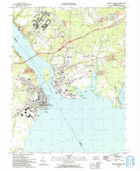
1992 Map of Havre De Grace
USGS Topo · Published 1993About this map
Havre De Grace and Perryville sit at the strategic confluence where the Susquehanna River meets the Chesapeake Bay. This 1990s-era topographic study details the dense street grids and civic infrastructure of these historic waterfront communities, including the Concord Pt Lighthouse and the sprawling Perry Point VA Medical Center. The landscape is defined by its transit corridors, featuring the tracks of Amtrak and Conrail alongside the John E Kennedy Memorial Highway.
Find a feature on this map
77 named features on this map. Tap any name to fly to it.
Don’t see what you’re looking for? This feature index may not catch every label — zoom into the map to look around manually.
Map Details
Editions of this 1992 Havre De Grace Map
This is the sole edition of this map. No revisions or reprints were ever made.
Other maps of this area

1898 · Elkton
USGS Topo · 1:62,500

1898 · Tolchester
USGS Topo · 1:125,000

1899 · Dover
USGS Topo · 1:125,000

1900 · Elkton
USGS Topo · 1:62,500

1900 · Cecilton
USGS Topo · 1:62,500

1900 · Havre De Grace
USGS Topo · 1:62,500

1900 · Betterton
USGS Topo · 1:62,500

1903 · Tolchester
USGS Topo · 1:125,000

1906 · Dover
USGS Topo · 1:125,000

1908 · Tolchester
USGS Topo · 1:125,000