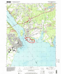
1998 Map of Havre De Grace
USGS Topo · Published 2000About this map
Havre De Grace and Perryville sit at the strategic meeting of the Susquehanna River and the Chesapeake Bay, shown here in a detailed late-1990s perspective. The landscape is defined by its deep maritime and industrial roots, featuring the historic Concord Pt Lighthouse and the sprawling Perry Point VA Medical Center. The transportation corridor is heavily marked by the John F Kennedy Memorial Highway and Conrail lines, which cut through the older settlements of Aikin and Blythedale.
Find a feature on this map
68 named features on this map. Tap any name to fly to it.
Don’t see what you’re looking for? This feature index may not catch every label — zoom into the map to look around manually.
Map Details
Editions of this 1998 Havre De Grace Map
This is the sole edition of this map. No revisions or reprints were ever made.
Other maps of this area

1898 · Elkton
USGS Topo · 1:62,500

1898 · Tolchester
USGS Topo · 1:125,000

1899 · Dover
USGS Topo · 1:125,000

1900 · Elkton
USGS Topo · 1:62,500

1900 · Cecilton
USGS Topo · 1:62,500

1900 · Havre De Grace
USGS Topo · 1:62,500

1900 · Betterton
USGS Topo · 1:62,500

1903 · Tolchester
USGS Topo · 1:125,000

1906 · Dover
USGS Topo · 1:125,000

1908 · Tolchester
USGS Topo · 1:125,000