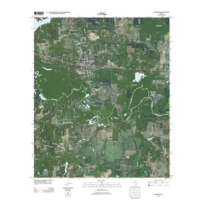
2012 Map of Hawkins
USGS Topo · Published 2012About this map
The Sabine River snakes through this East Texas landscape, forming a natural boundary south of the rail-and-road corridor that connects Hawkins and Big Sandy. This 2012 survey illustrates the area's industrial and educational character, prominently featuring the Hawkins Oil Field and the campus of Jarvis Christian Coll, which includes its own designated Jarvis Christian Coll Cem. The terrain north of the river is a network of country roads and family-named landmarks like Haney Cem and Kay Cem, reflecting generations of local history.
Find a feature on this map
105 named features on this map. Tap any name to fly to it.
Don’t see what you’re looking for? This feature index may not catch every label — zoom into the map to look around manually.
Map Details
Editions of this 2012 Hawkins Map
This is the sole edition of this map. No revisions or reprints were ever made.
Other maps of this area

1938 · Winona
USGS Topo · 1:48,000

1943 · Winona
USGS Topo · 1:62,500

1948 · Tyler
USGS Topo · 1:62,500

1949 · Tyler
USGS Topo · 1:62,500

1956 · Tyler
USGS Topo · 1:250,000

1960 · Shady Grove
USGS Topo · 1:24,000

1960 · Hawkins
USGS Topo · 1:24,000

1960 · Big Sandy
USGS Topo · 1:24,000

1960 · Pritchett
USGS Topo · 1:24,000

1960 · Hainesville
USGS Topo · 1:24,000