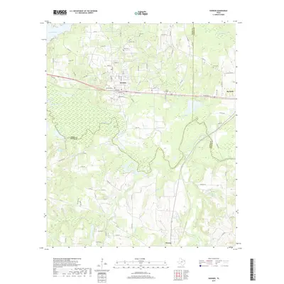
2019 Map of Hawkins
USGS Topo · Published 2019About this map
Hawkins sits at the intersection of local history and modern transport, positioned where several Texas county lines converge near the Sabine River. This 2019 survey captures the developed landscape around the Wood, Upshur, and Smith County boundaries, including the towns of Big Sandy and Winona. The topography is defined by significant water bodies such as Lake Hawkins, Bradford Lake, and Pinehurst Farms Lake, which break up the wooded terrain.
Find a feature on this map
90 named features on this map. Tap any name to fly to it.
Don’t see what you’re looking for? This feature index may not catch every label — zoom into the map to look around manually.
Map Details
Editions of this 2019 Hawkins Map
This is the sole edition of this map. No revisions or reprints were ever made.
Other maps of this area

1938 · Winona
USGS Topo · 1:48,000

1943 · Winona
USGS Topo · 1:62,500

1948 · Tyler
USGS Topo · 1:62,500

1949 · Tyler
USGS Topo · 1:62,500

1956 · Tyler
USGS Topo · 1:250,000

1960 · Shady Grove
USGS Topo · 1:24,000

1960 · Hawkins
USGS Topo · 1:24,000

1960 · Big Sandy
USGS Topo · 1:24,000

1960 · Pritchett
USGS Topo · 1:24,000

1960 · Hainesville
USGS Topo · 1:24,000