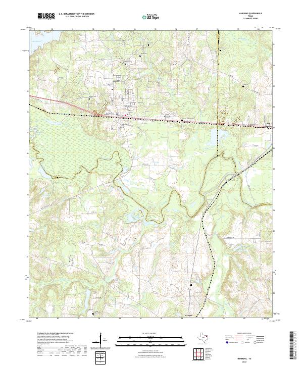
2022 Map of Hawkins
USGS Topo · Published 2022About this map
Jarvis Christian College stands as a central landmark in this East Texas landscape, positioned between the towns of Hawkins and Big Sandy. The map illustrates a region defined by the meandering Sabine River and its numerous tributaries, including Rogers Cr, Harris Cr, and Glade Cr. This 2022 survey captures the modern interface of academic infrastructure and rural Wood County history, visible through a high concentration of established burial grounds such as Haney Cem, Liberty Cem, and the Hawkins City Cem.
Find a feature on this map
99 named features on this map. Tap any name to fly to it.
Don’t see what you’re looking for? This feature index may not catch every label — zoom into the map to look around manually.
Map Details
Editions of this 2022 Hawkins Map
This is the sole edition of this map. No revisions or reprints were ever made.
Other maps of this area

1938 · Winona
USGS Topo · 1:48,000

1943 · Winona
USGS Topo · 1:62,500

1948 · Tyler
USGS Topo · 1:62,500

1949 · Tyler
USGS Topo · 1:62,500

1956 · Tyler
USGS Topo · 1:250,000

1960 · Shady Grove
USGS Topo · 1:24,000

1960 · Hawkins
USGS Topo · 1:24,000

1960 · Big Sandy
USGS Topo · 1:24,000

1960 · Pritchett
USGS Topo · 1:24,000

1960 · Hainesville
USGS Topo · 1:24,000