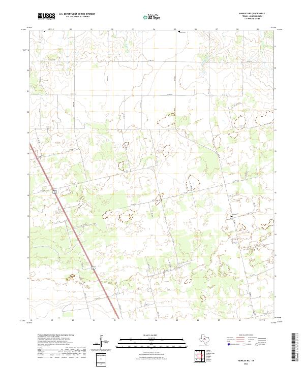
2022 Map of Hawley NE
USGS Topo · Published 2022About this map
Harmony Cr and Cottonwood Cr drain the open agricultural landscape of north-central Jones County, where a grid of rural roads and state highways connects scattered homesteads and burial grounds. This modern topographic survey highlights the enduring rural layout of the region, anchored by two primary places of rest: Bethel Cem in the north and Central Cem further south. The map documents a transportation network defined by a mix of established routes like FM 3326 and FM 3368, alongside numerous county and private roads such as Avenue E and Co RD 364. These routes serve the local ranching and farming interests that have long characterized this part of the Texas plains north of Abilene.
Find a feature on this map
52 named features on this map. Tap any name to fly to it.
Don’t see what you’re looking for? This feature index may not catch every label — zoom into the map to look around manually.
Map Details
Editions of this 2022 Hawley NE Map
This is the sole edition of this map. No revisions or reprints were ever made.
Other maps of this area

1891 · Anson
USGS Topo · 1:125,000

1893 · Anson
USGS Topo · 1:125,000

1954 · Abilene
USGS Topo · 1:250,000

1957 · Hawley
USGS Topo · 1:62,500

1957 · Nugent
USGS Topo · 1:62,500
1957 · Hawley
USGS Topo · 1:24,000
1957 · Hamby
USGS Topo · 1:24,000

1958 · Abilene
USGS Topo · 1:250,000

1965 · Lueders West
USGS Topo · 1:24,000
1965 · Funston
USGS Topo · 1:24,000