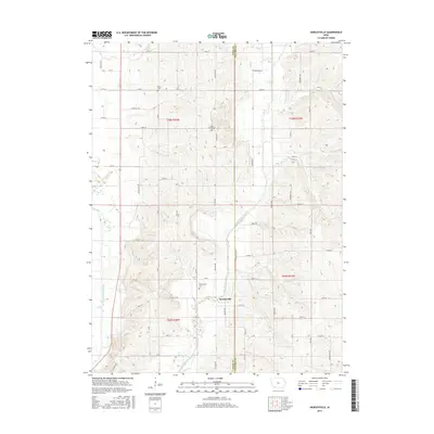
2015 Map of Hawleyville
USGS Topo · Published 2015About this map
Hawleyville sits at the heart of this rural landscape, situated along the meandering path of the East Nodaway River. This 2015 survey illustrates the enduring agricultural character of the region, where a grid of gravel roads like 180 St and Co Hwy J314 connects dispersed farmsteads across the undulating terrain. The preservation of local heritage is evident in the three well-marked burial grounds that serve the community, including Hawleyville Cem, North Grove Cem, and Valley Cem. These sites, along with the distinct drainage patterns of the West Nodaway River and Long Br, provide essential landmarks for genealogists and researchers tracing the settlement history of the Page and Taylor county border. The map emphasizes the intersection of water and roadway, showing how the local infrastructure still follows the natural contours of the river valleys.
Find a feature on this map
50 named features on this map. Tap any name to fly to it.
Don’t see what you’re looking for? This feature index may not catch every label — zoom into the map to look around manually.
Map Details
Editions of this 2015 Hawleyville Map
This is the sole edition of this map. No revisions or reprints were ever made.
Other maps of this area

1940 · Coin
USGS Topo · 1:62,500

1940 · New Market
USGS Topo · 1:62,500

1943 · Coin
USGS Topo · 1:62,500

1943 · New Market
USGS Topo · 1:62,500

1955 · Nebraska City
USGS Topo · 1:250,000

1957 · Nebraska City
USGS Topo · 1:250,000

1958 · Nebraska City
USGS Topo · 1:250,000

1978 · Stanton
USGS Topo · 1:24,000

1978 · Clarinda North
USGS Topo · 1:24,000

1980 · Guss
USGS Topo · 1:24,000