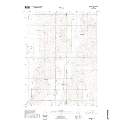
2018 Map of Hawleyville
USGS Topo · Published 2018About this map
Hawleyville serves as the focal point of this rural landscape, situated at the border of Page and Taylor counties. The area is defined by the winding paths of the East Nodaway River and the West Nodaway River, which carve through the agricultural terrain. For those tracing family histories, the map identifies several local burial grounds including Hawleyville Cem just outside the settlement, North Grove Cem to the north, and Valley Cem near the northern boundary. The infrastructure is primarily composed of a regular grid of section roads like 120th St and 200 St, connected by regional arteries such as Co Hwy J31. Smaller tributaries like Long Br feed into the river system, illustrating the natural drainage patterns that have historically dictated the placement of farms and small communities in this corner of Iowa.
Find a feature on this map
46 named features on this map. Tap any name to fly to it.
Don’t see what you’re looking for? This feature index may not catch every label — zoom into the map to look around manually.
Map Details
Editions of this 2018 Hawleyville Map
This is the sole edition of this map. No revisions or reprints were ever made.
Other maps of this area

1940 · Coin
USGS Topo · 1:62,500

1940 · New Market
USGS Topo · 1:62,500

1943 · Coin
USGS Topo · 1:62,500

1943 · New Market
USGS Topo · 1:62,500

1955 · Nebraska City
USGS Topo · 1:250,000

1957 · Nebraska City
USGS Topo · 1:250,000

1958 · Nebraska City
USGS Topo · 1:250,000

1978 · Stanton
USGS Topo · 1:24,000

1978 · Clarinda North
USGS Topo · 1:24,000

1980 · Guss
USGS Topo · 1:24,000