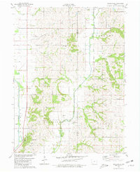
1980 Map of Hawleyville
USGS Topo · Published 1981About this map
Hawleyville sits at the confluence where the East Nodaway River and West Nodaway River join, marking a historic crossing point in southwest Iowa. This 1980 survey illustrates a rural landscape defined by the drainage basins of the Nebraska, Dallas, and Nodaway townships. The map is a valuable resource for genealogists, as it identifies several burial grounds including Hawleyville Cem, Valley Cem, and North Grove Cem. Modern land use is evident in the development of the Nodaway Valley County Park, which features a designated Picnic Area and Campground. The terrain is further detailed by the course of Wolf Run to the north, while a Radio Tower stands as a contemporary landmark in an otherwise traditional agricultural setting along the Page Co and Taylor Co boundary.
Find a feature on this map
16 named features on this map. Tap any name to fly to it.
Don’t see what you’re looking for? This feature index may not catch every label — zoom into the map to look around manually.
Map Details
Editions of this 1980 Hawleyville Map
This is the sole edition of this map. No revisions or reprints were ever made.
Other maps of this area

1940 · Coin
USGS Topo · 1:62,500

1940 · New Market
USGS Topo · 1:62,500

1943 · Coin
USGS Topo · 1:62,500

1943 · New Market
USGS Topo · 1:62,500

1955 · Nebraska City
USGS Topo · 1:250,000

1957 · Nebraska City
USGS Topo · 1:250,000

1958 · Nebraska City
USGS Topo · 1:250,000

1978 · Stanton
USGS Topo · 1:24,000

1978 · Clarinda North
USGS Topo · 1:24,000

1980 · Guss
USGS Topo · 1:24,000