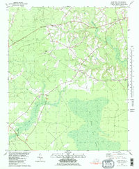
1981 Map of Haws Run
USGS Topo · Published 1981About this map
Great Sandy Run Pocosin dominates the southern landscape, illustrating the expansive wetland environments of eastern North Carolina in the late 1970s. The settlement pattern follows higher ground along established roads, connecting small communities like Waltons Store and Cyrus. Local life is anchored by a dense network of country churches, including Harris Creek Ch, Pineland Ch, and Calvary Ch, many with adjacent cemeteries that serve as vital markers for genealogical research. The map also documents the transition of transportation, from the secluded Landing Strip near Padgett and the Sky Manor Airport to the intricate drainage of Southwest Creek and Little Sandy Run Swamp. These features reflect a rural economy and social structure deeply tied to the land's hydrology and the resilience of its small crossroads hamlets.
Find a feature on this map
20 named features on this map. Tap any name to fly to it.
Don’t see what you’re looking for? This feature index may not catch every label — zoom into the map to look around manually.
Map Details
Editions of this 1981 Haws Run Map
2 editions found
Other maps of this area

1943 · Jacksonville
USGS Topo · 1:62,500

1948 · Maple Hill
USGS Topo · 1:62,500

1948 · New River
USGS Topo · 1:62,500

1948 · Richlands
USGS Topo · 1:62,500

1952 · Jacksonville South
USGS Topo · 1:24,000

1952 · Sneads Ferry
USGS Topo · 1:24,000

1953 · Beaufort
USGS Topo · 1:250,000

1954 · Beaufort
USGS Topo · 1:250,000

1965 · Richlands
USGS Topo · 1:62,500

1972 · Beaufort
USGS Topo · 1:250,000