
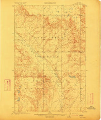
1912 Map of Hay Creek
USGS Topo · Published 1912About this map
Fort Peck Indian Reservation lands dominate this 1909 survey of northeastern Montana, revealing a landscape defined by the winding course of the Poplar River. The topography transitions from the alluvial flats of the river valley to intricate dissected uplands, with elevation markers tracing the ridges above Hay and Smoke Creek. While much of the territory remains open rangeland, the presence of Kerns Ranch provides a specific point of reference for early 20th-century settlement patterns in Roosevelt County. The map reflects the early administrative efforts of the General Land Office to formalize township and range boundaries across the reservation's rugged interior during a period of transition for the region.
Find a feature on this map
9 named features on this map. Tap any name to fly to it.
Don’t see what you’re looking for? This feature index may not catch every label — zoom into the map to look around manually.
Map Details
Editions of this 1912 Hay Creek Map
2 editions found
Other maps of this area

1909 · Smoke Creek
USGS Topo · 1:62,500

1910 · Cuskers
USGS Topo · 1:62,500

1912 · Chelsea
USGS Topo · 1:62,500

1912 · Poplar
USGS Topo · 1:62,500

1912 · Smoke Creek
USGS Topo · 1:62,500

1914 · Brockton
USGS Topo · 1:62,500

1915 · Cuskers
USGS Topo · 1:62,500

1954 · Wolf Point
USGS Topo · 1:250,000

1958 · Wolf Point
USGS Topo · 1:250,000

1972 · Chelsea
USGS Topo · 1:24,000