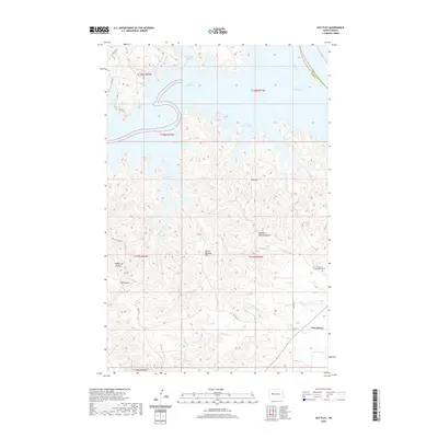
2020 Map of Hay Flat
USGS Topo · Published 2020About this map
Lake Sakakawea dominates the northern reaches of this landscape, its fingers reaching into the broken terrain of the Fort Berthold Reservation through Water Chief Bay and McKenzie Bay. The high ground of Hay Flat and Mower Machine Flat rises above the drainage of Bear Creek, illustrating the complex interplay between the Missouri River basin and the eroded draws of the North Dakota badlands. In the southeast, the community of Twin Buttes serves as a focal point for the region, anchored by the Twin Buttes Congregational Cem. The map reveals a network of local routes including Bia Rte 22 and Bia Rte 20, which navigate around prominent landmarks like Old Man Dancing Butte. This modern survey tracks the contemporary shoreline where the Missouri River meets the reservoir, alongside traditional grazing lands and coulees.
Find a feature on this map
26 named features on this map. Tap any name to fly to it.
Don’t see what you’re looking for? This feature index may not catch every label — zoom into the map to look around manually.
Map Details
Editions of this 2020 Hay Flat Map
This is the sole edition of this map. No revisions or reprints were ever made.
Other maps of this area

1953 · Watford City
USGS Topo · 1:250,000

1957 · Watford City
USGS Topo · 1:250,000

1967 · Watford City
USGS Topo · 1:250,000

1967 · Raub NW
USGS Topo · 1:24,000

1967 · Twin Buttes
USGS Topo · 1:24,000

1970 · Halliday NE
USGS Topo · 1:24,000

1970 · Hay Flat
USGS Topo · 1:24,000

1970 · String Buttes
USGS Topo · 1:24,000

1970 · Golden Valley NW
USGS Topo · 1:24,000

1970 · Halliday NW
USGS Topo · 1:24,000