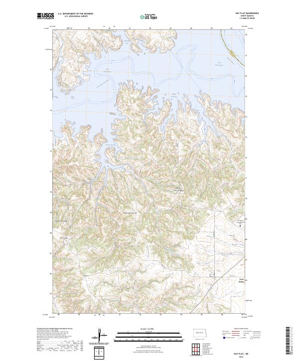
2024 Map of Hay Flat
USGS Topo · Published 2024About this map
Lake Sakakawea dominates the northern landscape of this region, where the Missouri River meets the flooded mouth of the Little Missouri River. The terrain is defined by a series of expansive bays and intricate coulees, including McKenzie Bay, Bear Creek Bay, and Chief Bay. Away from the water, the land rises into prominent flats and ridges, most notably Hay Flat and Mower Machine Flat. Local history is anchored at the settlement of Twin Buttes, situated near the Twin Buttes Congregational Cem. The geography is further marked by distinctive landmarks like Old Man Dancing Butte, while drainage systems like the East Fork Bear Creek and Sagebrush Coulee carve through the prairie. This area, largely managed through Bureau of Indian Affairs routes like BIA Rte 22, reflects the complex intersection of natural water systems and high-plains topography.
Find a feature on this map
28 named features on this map. Tap any name to fly to it.
Don’t see what you’re looking for? This feature index may not catch every label — zoom into the map to look around manually.
Map Details
Editions of this 2024 Hay Flat Map
This is the sole edition of this map. No revisions or reprints were ever made.
Other maps of this area

1953 · Watford City
USGS Topo · 1:250,000

1957 · Watford City
USGS Topo · 1:250,000

1967 · Watford City
USGS Topo · 1:250,000

1967 · Raub NW
USGS Topo · 1:24,000

1967 · Twin Buttes
USGS Topo · 1:24,000

1970 · Halliday NE
USGS Topo · 1:24,000

1970 · Hay Flat
USGS Topo · 1:24,000

1970 · String Buttes
USGS Topo · 1:24,000

1970 · Golden Valley NW
USGS Topo · 1:24,000

1970 · Halliday NW
USGS Topo · 1:24,000