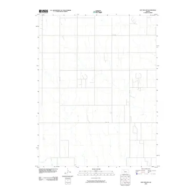
2009 Map of Hay Hollow
USGS Topo · Published 2009About this map
The North Fork Saline River cuts through the southwestern corner of this Kansas landscape, defining the primary drainage for the surrounding prairie. This area of Trego County is characterized by a regular grid of section roads that facilitate movement across the agricultural terrain, including routes such as Co Rd 639 and Co Rd 406. The dendritic patterns of Happy Creek branch across the central and northern sections of the map, revealing the subtle relief and natural drainage ways that dictate the placement of farmsteads and field boundaries. This topographic study captures the essential infrastructure of the rural High Plains, where long stretches of road like 240 Ave and Co Rd 418 connect isolated homesteads to the wider regional network during the early 21st century.
Find a feature on this map
7 named features on this map. Tap any name to fly to it.
Don’t see what you’re looking for? This feature index may not catch every label — zoom into the map to look around manually.
Map Details
Editions of this 2009 Hay Hollow Map
This is the sole edition of this map. No revisions or reprints were ever made.
Other maps of this area

1893 · Hill
USGS Topo · 1:125,000

1954 · Goodland
USGS Topo · 1:250,000

1955 · Beloit
USGS Topo · 1:250,000

1956 · Goodland
USGS Topo · 1:250,000

1957 · Goodland
USGS Topo · 1:250,000

1959 · Beloit
USGS Topo · 1:250,000
1962 · Wa Keeney East
USGS Topo · 1:24,000
1963 · Wa Keeney West
USGS Topo · 1:24,000

1979 · Hill City South
USGS Topo · 1:24,000

1979 · Morland
USGS Topo · 1:24,000