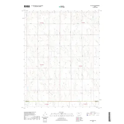
2018 Map of Hay Hollow
USGS Topo · Published 2018About this map
The N Fork Saline River defines the southern boundary of this landscape, flowing through the border between Graham and Trego counties. The terrain is characterized by the expansive drainage of Hay Hollow and the winding course of Happy Cr, which meanders through the northern sections of the survey. The mapping reveals a precise grid of rural infrastructure, where local routes like Co Rd 406 and Co Rd 418 intersect with long-established north-south avenues. This system of section-line roads, such as 220th Ave and 240th Ave, reflects the organized land division typical of the High Plains, providing a clear view of property access and topography in this part of western Kansas.
Find a feature on this map
29 named features on this map. Tap any name to fly to it.
Don’t see what you’re looking for? This feature index may not catch every label — zoom into the map to look around manually.
Map Details
Editions of this 2018 Hay Hollow Map
This is the sole edition of this map. No revisions or reprints were ever made.
Other maps of this area

1893 · Hill
USGS Topo · 1:125,000

1954 · Goodland
USGS Topo · 1:250,000

1955 · Beloit
USGS Topo · 1:250,000

1956 · Goodland
USGS Topo · 1:250,000

1957 · Goodland
USGS Topo · 1:250,000

1959 · Beloit
USGS Topo · 1:250,000
1962 · Wa Keeney East
USGS Topo · 1:24,000
1963 · Wa Keeney West
USGS Topo · 1:24,000

1979 · Hill City South
USGS Topo · 1:24,000

1979 · Morland
USGS Topo · 1:24,000