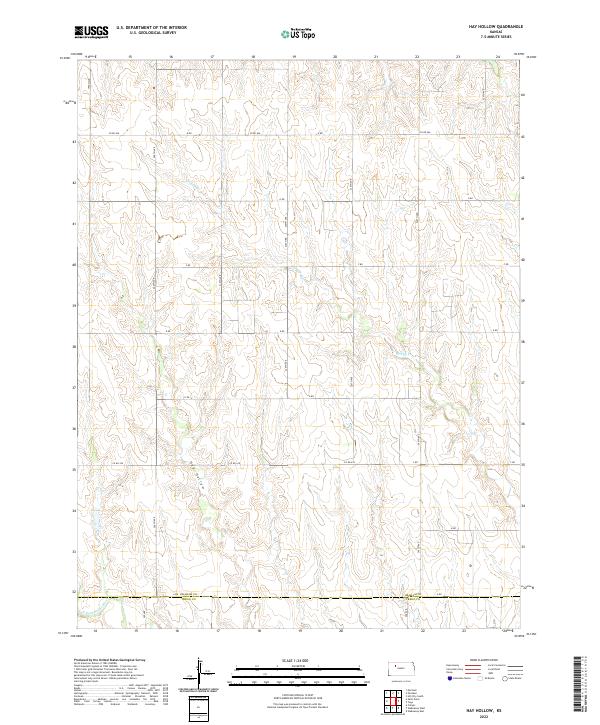
2022 Map of Hay Hollow
USGS Topo · Published 2022About this map
Hay Hollow defines the drainage pattern of this rural Kansas landscape, where the terrain slopes toward the N Fork Saline River at the southern edge of the sheet. The map documents the precise boundary between Graham and Trego Counties, a line that separates the townships of T10S and T11S. This agricultural region is structured by a strict section-line road grid, including H Rd, G Rd, and E Rd, which connect remote farmsteads across the high plains. Tributaries like Happy Cr weave through the northern sections, creating the subtle relief that characterizes the Graham County countryside. This survey provides a modern view of the land division and water resources in a part of the state where geography is dictated by the slow erosion of prairie creeks and the steady geometry of the public land survey system.
Find a feature on this map
29 named features on this map. Tap any name to fly to it.
Don’t see what you’re looking for? This feature index may not catch every label — zoom into the map to look around manually.
Map Details
Editions of this 2022 Hay Hollow Map
This is the sole edition of this map. No revisions or reprints were ever made.
Other maps of this area

1893 · Hill
USGS Topo · 1:125,000

1954 · Goodland
USGS Topo · 1:250,000

1955 · Beloit
USGS Topo · 1:250,000

1956 · Goodland
USGS Topo · 1:250,000

1957 · Goodland
USGS Topo · 1:250,000

1959 · Beloit
USGS Topo · 1:250,000
1962 · Wa Keeney East
USGS Topo · 1:24,000
1963 · Wa Keeney West
USGS Topo · 1:24,000

1979 · Hill City South
USGS Topo · 1:24,000

1979 · Morland
USGS Topo · 1:24,000