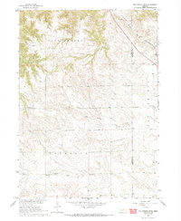
1966 Map of Hay Springs Creek
USGS Topo · Published 1993About this map
Hay Springs and the surrounding Nebraska ranchland are captured here during a 1965 survey, documenting the rural landscape of the Missouri River Basin. The terrain is marked by significant topographical relief, including the East Chadron and Antelope regions, which dictate the winding paths of Bordeaux Creek and Hay Springs Creek. A series of country schoolhouses, including Antelope Sch, Pleasant Home Sch, and Pleasant Valley Sch, provide a clear record of the area's dispersed population and mid-century social structure. The Chicago and North Western railroad cuts across the northeastern corner of the map, serving as the primary commercial artery for this High Plains territory. Along the tracks, a Cem and a Gravel Pit indicate local infrastructure near the Dawes and Sheridan County line, offering researchers a look at land use before modern agricultural shifts.
Find a feature on this map
12 named features on this map. Tap any name to fly to it.
Don’t see what you’re looking for? This feature index may not catch every label — zoom into the map to look around manually.
Map Details
Editions of this 1966 Hay Springs Creek Map
2 editions found
Other maps of this area

1955 · Alliance
USGS Topo · 1:250,000

1957 · Alliance
USGS Topo · 1:250,000

1958 · Alliance
USGS Topo · 1:250,000

1960 · Hay Springs SW
USGS Topo · 1:24,000

1966 · Chadron 3 SE
USGS Topo · 1:24,000

1966 · Hay Springs
USGS Topo · 1:24,000

1966 · Chadron 3 NE
USGS Topo · 1:24,000
1966 · Chadron 3 SW
USGS Topo · 1:24,000

1969 · Bordeaux
USGS Topo · 1:24,000
1969 · Whiteclay SW
USGS Topo · 1:24,000