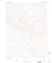
1971 Map of Hayden Gulch
USGS Topo · Published 1974About this map
Williams Fork Mountains dominate this high-country landscape, defined by a network of drainage gulches and resource extraction in the early 1970s. The area shows a transition toward energy development, marked by a Strip Mine, several smaller Mine sites, a Gas Well, and numerous Drill Hole locations throughout the terrain. Water management is central to the map's geography, featuring several named reservoirs like Dillabaugh Res, Detwiller Res, and the larger Wyman Reservoir at the southern edge. The northern half is deeply incised by drainages such as Berry Gulch, Temple Gulch, and Hayden Gulch, while the southern portion transitions into the protected lands of the Routt National Forest. The presence of a Gaging Sta along the East Fork Williams Fork reflects the ongoing hydrological monitoring of these vital Colorado headwaters.
Find a feature on this map
28 named features on this map. Tap any name to fly to it.
Don’t see what you’re looking for? This feature index may not catch every label — zoom into the map to look around manually.
Map Details
Editions of this 1971 Hayden Gulch Map
3 editions found
Other maps of this area

1916 · Daton Peak
USGS Topo · 1:62,500

1920 · Daton Peak
USGS Topo · 1:62,500

1924 · Mt. Harris
USGS Topo · 1:48,000

1926 · Mount Harris
USGS Topo · 1:62,500

1954 · Craig
USGS Topo · 1:250,000

1957 · Craig
USGS Topo · 1:250,000

1958 · Craig
USGS Topo · 1:250,000

1960 · Craig
USGS Topo · 1:250,000

1962 · Craig
USGS Topo · 1:250,000

1964 · Craig
USGS Topo · 1:250,000