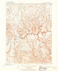
1901 Map of Hayden Peak
USGS Topo · Published 1967About this map
Hayden Peak and the surrounding high country of the Uinta Mountains dominate this survey, recorded just after the turn of the century by surveyors W. J. Lloyd and Jeremiah Ahern. The landscape is defined by its dramatic hydrography, showing the headwaters of major Western river systems including the Bear River, Weber River, Duchesne River, and Provo River. The mapping captures a pristine mountain wilderness before modern road developments, highlighting dozens of high-altitude basins like Grandaddy Lake, Mirror Lake, and Moon Lake.
Find a feature on this map
49 named features on this map. Tap any name to fly to it.
Don’t see what you’re looking for? This feature index may not catch every label — zoom into the map to look around manually.
Map Details
Editions of this 1901 Hayden Peak Map
2 editions found
Other maps of this area

1885 · Salt Lake
USGS Topo · 1:250,000

1885 · Uinta
USGS Topo · 1:250,000

1900 · Coalville
USGS Topo · 1:125,000

1901 · Hayden Peak
USGS Topo · 1:125,000

1903 · Hayden Peak
USGS Topo · 1:125,000

1903 · Coalville
USGS Topo · 1:125,000

1905 · Gilbert Peak
USGS Topo · 1:125,000

1906 · Gilbert Peak
USGS Topo · 1:125,000

1907 · Strawberry Valley
USGS Topo · 1:125,000

1909 · Strawberry Valley
USGS Topo · 1:125,000
Featured Places
- Christmas Meadow Summer Homes, UT
- Moon Lake Lodge, UT
- Summit County, UT
- Wasatch County, UT
- Duchesne County, UT