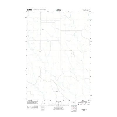
2012 Map of Haydraw
USGS Topo · Published 2012About this map
Haydraw is situated in a rural expanse of Meade County, defined by a sparse network of section roads and seasonal watercourses. The drainage patterns of Hay Cr, E Elm Cr, and W Bull Cr carve through the landscape, illustrating the hydrology of this western South Dakota prairie. For those researching local history or genealogy, the Haydraw Cem serves as a significant landmark north of the primary settlement cluster. The road system, including Co Hwy Mc-27 and Hay Draw Rd, follows the rigid grid typical of the Great Plains, connecting remote homesteads and ranching properties. This map captures the area in the early 21st century, showing how modern transportation routes like 167th Ave and Oxbow Pl overlay the traditional agrarian territory.
Find a feature on this map
13 named features on this map. Tap any name to fly to it.
Don’t see what you’re looking for? This feature index may not catch every label — zoom into the map to look around manually.
Map Details
Editions of this 2012 Haydraw Map
This is the sole edition of this map. No revisions or reprints were ever made.
Other maps of this area

1953 · Hereford SE
USGS Topo · 1:24,000

1953 · Hereford NE
USGS Topo · 1:24,000

1953 · Rapid City
USGS Topo · 1:250,000

1954 · Elm Springs SW
USGS Topo · 1:24,000

1954 · Haydraw
USGS Topo · 1:24,000

1954 · Elm Springs
USGS Topo · 1:24,000

1954 · Boneita Springs
USGS Topo · 1:24,000

1957 · Rapid City
USGS Topo · 1:250,000

1959 · Enning
USGS Topo · 1:24,000

1959 · Union Center
USGS Topo · 1:24,000