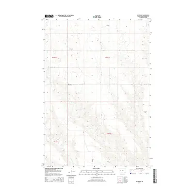
2015 Map of Haydraw
USGS Topo · Published 2015About this map
The settlement of Haydraw serves as the focal point of this rural Meade County landscape, where the prairie begins to break into the drainage systems of the northern plains. A network of section-line roads, including Hay Draw RD and Hope RD, grid the open country, providing access to the scattered homesteads and ranching tracts typical of this region. Local history is anchored by the Haydraw Cem, a quiet landmark situated north of the main settlement. The topography is defined by the winding paths of Hay Cr, E Elm Cr, and W Bull Cr, which carve subtle valleys into the surrounding high ground. To the east, the terrain levels out significantly at Harwood Flat, illustrating the diverse elevations that characterize the transition between traditional farmland and the more undulating creek-side breaks.
Find a feature on this map
18 named features on this map. Tap any name to fly to it.
Don’t see what you’re looking for? This feature index may not catch every label — zoom into the map to look around manually.
Map Details
Editions of this 2015 Haydraw Map
This is the sole edition of this map. No revisions or reprints were ever made.
Other maps of this area

1953 · Hereford SE
USGS Topo · 1:24,000

1953 · Hereford NE
USGS Topo · 1:24,000

1953 · Rapid City
USGS Topo · 1:250,000

1954 · Elm Springs SW
USGS Topo · 1:24,000

1954 · Haydraw
USGS Topo · 1:24,000

1954 · Elm Springs
USGS Topo · 1:24,000

1954 · Boneita Springs
USGS Topo · 1:24,000

1957 · Rapid City
USGS Topo · 1:250,000

1959 · Enning
USGS Topo · 1:24,000

1959 · Union Center
USGS Topo · 1:24,000