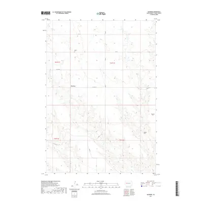
2017 Map of Haydraw
USGS Topo · Published 2017About this map
Haydraw sits within a wide agricultural landscape of western South Dakota, characterized by the drainage patterns of Hay Cr and the intermittent flow of E Elm Cr. This rural expanse in Meade County is defined by its sectional grid system, where long stretches of road like Hay Draw Rd and Hope Rd navigate the local terrain. The presence of the Haydraw Cem serves as a primary point of local history, marking the community's heritage in an area where the topography transitions into the prominent Harwood Flat to the east. The map illustrates a sparse settlement pattern typical of the region's ranching and farming history, with natural features like Maddox Draw carving through the plains. Local connectivity is maintained through thoroughfares such as Co Hwy Mc-27, which intersects the southern portion of the township as it crosses the grassy draws.
Find a feature on this map
16 named features on this map. Tap any name to fly to it.
Don’t see what you’re looking for? This feature index may not catch every label — zoom into the map to look around manually.
Map Details
Editions of this 2017 Haydraw Map
This is the sole edition of this map. No revisions or reprints were ever made.
Other maps of this area

1953 · Hereford SE
USGS Topo · 1:24,000

1953 · Hereford NE
USGS Topo · 1:24,000

1953 · Rapid City
USGS Topo · 1:250,000

1954 · Elm Springs SW
USGS Topo · 1:24,000

1954 · Haydraw
USGS Topo · 1:24,000

1954 · Elm Springs
USGS Topo · 1:24,000

1954 · Boneita Springs
USGS Topo · 1:24,000

1957 · Rapid City
USGS Topo · 1:250,000

1959 · Enning
USGS Topo · 1:24,000

1959 · Union Center
USGS Topo · 1:24,000